IMAGES TAKEN NEAR TO
Frenchfields Crescent, ST. HELENS, WA9 4FZ
Introduction
This page details the photographs taken nearby to Frenchfields Crescent, WA9 4FZ by members of the Geograph project.
The Geograph project started in 2005 with the aim of publishing, organising and preserving representative images for every square kilometre of Great Britain, Ireland and the Isle of Man.

There are currently over 7.5m images from over14,400 individuals and you can help contribute to the project by visiting https://www.geograph.org.uk
Image Map
Images are licensed for reuse under creativecommons.org/licenses/by-sa/2.0
Notes
- Clicking on the map will re-center to the selected point.
- The higher the marker number, the further away the image location is from the centre of the postcode.
Image Listing (16 Images Found)
Images are licensed for reuse under creativecommons.org/licenses/by-sa/2.0
Image
Details
Distance
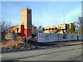
1
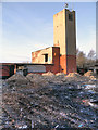
Clock Face Colliery Remains
Clock Face Colliery Country Park lies on the site of a former colliery, dating back to the early 1890s.
The colliery took its name from the local Clock Face Inn and Clock Face Road (SJ5291 : The Clock Face). At its peak, the colliery was producing 160000 tons of coal per annum and employed over 700 people however, in 1965, the NCB declared the colliery uneconomical due to geological difficulties and closed the site the following year.
Image: © David Dixon
Taken: 8 Feb 2013
0.01 miles
2
Former Clock Face Colliery Buildings
Clock Face Colliery Country Park lies on the site of a former colliery, dating back to the early 1890s.
The colliery took its name from the local Clock Face Inn and Clock Face Road (SJ5291 : The Clock Face). At its peak, the colliery was producing 160000 tons of coal per annum and employed over 700 people however, in 1965, the NCB declared the colliery uneconomical due to geological difficulties and closed the site the following year.
Image: © David Dixon
Taken: 8 Feb 2013
0.01 miles
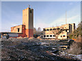
3
Remains of Colliery Buildings, Clock Face
Clock Face Colliery Country Park lies on the site of a former colliery, dating back to the early 1890s.
The colliery took its name from the local Clock Face Inn and Clock Face Road (SJ5291 : The Clock Face). At its peak, the colliery was producing 160000 tons of coal per annum and employed over 700 people however, in 1965, the NCB declared the colliery uneconomical due to geological difficulties and closed the site the following year.
Image: © David Dixon
Taken: 8 Feb 2013
0.02 miles
5
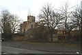
Former office and baths block, Clock Face Colliery
Image: © David Long
Taken: 18 Jan 2010
0.02 miles
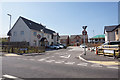
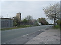
6
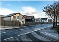
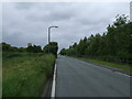
Gorsey Lane
New houses alongside Gorsey Lane.
Image: © Peter McDermott
Taken: 3 Jan 2021
0.04 miles
7
Gorsey Lane and disused Clock Face colliery buildings
Image: © Colin Pyle
Taken: 15 Apr 2011
0.04 miles
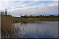
8
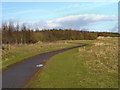
Path in Clock face Colliery Country park
Image: © David Dixon
Taken: 8 Feb 2013
0.11 miles