IMAGES TAKEN NEAR TO
Dykin Close, WIDNES, WA8 3HP
Introduction
This page details the photographs taken nearby to Dykin Close, WA8 3HP by members of the Geograph project.
The Geograph project started in 2005 with the aim of publishing, organising and preserving representative images for every square kilometre of Great Britain, Ireland and the Isle of Man.

There are currently over 7.5m images from over14,400 individuals and you can help contribute to the project by visiting https://www.geograph.org.uk
Image Map
Images are licensed for reuse under creativecommons.org/licenses/by-sa/2.0
Notes
- Clicking on the map will re-center to the selected point.
- The higher the marker number, the further away the image location is from the centre of the postcode.
Image Listing (11 Images Found)
Images are licensed for reuse under creativecommons.org/licenses/by-sa/2.0
Image
Details
Distance
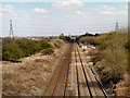
1
Railway (W) at Barrow's Green
Looking west, towards Liverpool, from the bridge at Barrow's Green Lane.
Image: © David Dixon
Taken: 20 Apr 2013
0.06 miles
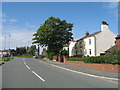
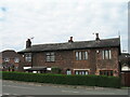
2
Barrow's Green Lane, Widnes
Barrow's Green Lane, Widnes with Cuerdley Cottage to the centre, marked as Wood End Farm on my old map.
Image: © Sue Adair
Taken: 8 Jun 2007
0.10 miles
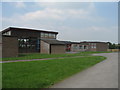
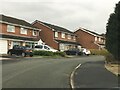
5
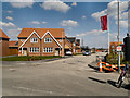
New Housing development, Barrow's Green
Image: © David Dixon
Taken: 20 Apr 2013
0.12 miles
6
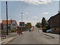
Roadworks on Barrow's Green Lane
Temporary traffic lights at the approach to the railway bridge on Barrow's Green Lane. Possibly connected to the new housing development being built to the left.
Image: © David Dixon
Taken: 20 Apr 2013
0.13 miles
7
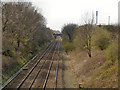
Railway (E) at Barrow's Green
Looking east, towards Warrington, from the bridge at Barrow's Green Lane.
Image: © David Dixon
Taken: 20 Apr 2013
0.14 miles
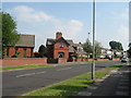
10
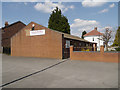
Kingdom Hall of Jehovah's Witnesses
At the junction of Moorfield Road and Dykin Road.
Image: © David Dixon
Taken: 20 Apr 2013
0.21 miles