
IMAGES TAKEN NEAR TO
Longshaw Street, WARRINGTON, WA5 0HT
Introduction
This page details the photographs taken nearby to Longshaw Street, WA5 0HT by members of the Geograph project.
The Geograph project started in 2005 with the aim of publishing, organising and preserving representative images for every square kilometre of Great Britain, Ireland and the Isle of Man.

There are currently over 7.5m images from over14,400 individuals and you can help contribute to the project by visiting https://www.geograph.org.uk
Image Map
Images are licensed for reuse under creativecommons.org/licenses/by-sa/2.0
Notes
- Clicking on the map will re-center to the selected point.
- The higher the marker number, the further away the image location is from the centre of the postcode.
Image Listing (17 Images Found)
Images are licensed for reuse under creativecommons.org/licenses/by-sa/2.0
Image
Details
Distance
2
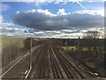
West Coast Main Line from A574 Bridge, Warrington
Image: © Richard Cooke
Taken: 14 Feb 2016
0.10 miles
3
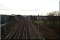
West Coast Main Line, looking South from Cromwell Avenue at Winwick Quay
The large factory shed with the irregular pitched roof on the left is the former factory of steel company Dorman Long. The Dallam Council housing estate is on the right.
Image: © David Long
Taken: 13 Feb 2009
0.11 miles
5
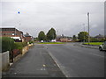
Harrison Square roundabout, Dallam
Seen from Longshaw Street, which continues north beyond the roundabout. Buses serving Dallam turn at the roundabout, either to return to Warrington town centre or to continue via Hawleys Lane to Longford and Orford.
Image: © Richard Vince
Taken: 12 Sep 2015
0.14 miles
8
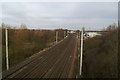
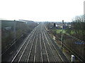
West Coast Main Line, looking North from Cromwell Avenue at Winwick Quay
Image: © David Long
Taken: 13 Feb 2009
0.18 miles
9
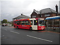
Bus on Longshaw Street, Dallam
One of Network Warrington's large fleet of DAF/VDL SB120/Wright Cadets lays over at the terminus just south of Harrison Square in Dallam, before working a 16A back to the town centre. Network Warrington currently faces competition from two other operators on this route, Fairbrother's and GHA Coaches.
Image: © Richard Vince
Taken: 12 Sep 2015
0.18 miles
10
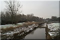
Sankey Brook, looking South from Cromwell Avenue
The watercourse is actually that of the Sankey Canal (originally known as the Sankey Brook Navigation when created in 1757). The waters of the brook were diverted into its channel because its original course runs through an area liable to flooding (the brook is tidal for some miles upstream) upon which the Dallam Council housing estate was built between the wars. The original width of the canal may be appreciated from this view.
Image: © David Long
Taken: 5 Feb 2009
0.18 miles