IMAGES TAKEN NEAR TO
Chiswick Gardens, WARRINGTON, WA4 5HQ
Introduction
This page details the photographs taken nearby to Chiswick Gardens, WA4 5HQ by members of the Geograph project.
The Geograph project started in 2005 with the aim of publishing, organising and preserving representative images for every square kilometre of Great Britain, Ireland and the Isle of Man.

There are currently over 7.5m images from over14,400 individuals and you can help contribute to the project by visiting https://www.geograph.org.uk
Image Map
Images are licensed for reuse under creativecommons.org/licenses/by-sa/2.0
Notes
- Clicking on the map will re-center to the selected point.
- The higher the marker number, the further away the image location is from the centre of the postcode.
Image Listing (11 Images Found)
Images are licensed for reuse under creativecommons.org/licenses/by-sa/2.0
Image
Details
Distance
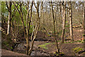
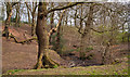
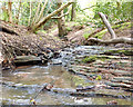
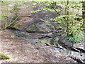
1
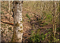
The Dingle
Sandstone outcrop above the Lumb Brook, not far from the road.
Image: © Dave Dunford
Taken: 19 Sep 2009
0.07 miles
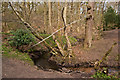
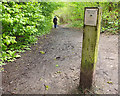
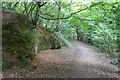
7
Entrance to The Dingle
A pleasant streamside footpath leaves the road here to follow the valley of the Lumb Brook.
Image: © Dave Dunford
Taken: 19 Sep 2009
0.15 miles
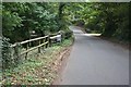
9
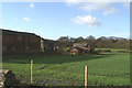
Still stood there
Marked as the Stud Farm on the older maps.
Image: © David Long
Taken: 20 Jan 2006
0.20 miles