IMAGES TAKEN NEAR TO
Boddington Drive, WARRINGTON, WA4 3HB
Introduction
This page details the photographs taken nearby to Boddington Drive, WA4 3HB by members of the Geograph project.
The Geograph project started in 2005 with the aim of publishing, organising and preserving representative images for every square kilometre of Great Britain, Ireland and the Isle of Man.

There are currently over 7.5m images from over14,400 individuals and you can help contribute to the project by visiting https://www.geograph.org.uk
Image Map
Images are licensed for reuse under creativecommons.org/licenses/by-sa/2.0
Notes
- Clicking on the map will re-center to the selected point.
- The higher the marker number, the further away the image location is from the centre of the postcode.
Image Listing (8 Images Found)
Images are licensed for reuse under creativecommons.org/licenses/by-sa/2.0
Image
Details
Distance
4
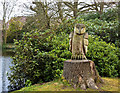
A carved owl at Grappenhall Heys Walled Garden
Image: © Ian Greig
Taken: 10 Apr 2015
0.23 miles
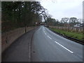
5
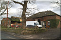
A shadow of its former self
Dairy Farm looks a bit down at heel nowadays
Image: © David Long
Taken: 20 Jan 2006
0.23 miles
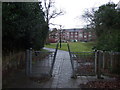
6
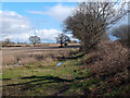
Footpath from Wright's Green to Grappenhall Lane
Image: © Gary Rogers
Taken: 28 Mar 2018
0.23 miles
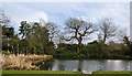
8
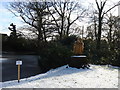
Grappenhall Heys Walled Garden
Owl, tree stump Carving
Image: © Howard Rolph
Taken: 17 Jan 2010
0.25 miles