
IMAGES TAKEN NEAR TO
Cross Lane, WARRINGTON, WA4 2LR
Introduction
This page details the photographs taken nearby to Cross Lane, WA4 2LR by members of the Geograph project.
The Geograph project started in 2005 with the aim of publishing, organising and preserving representative images for every square kilometre of Great Britain, Ireland and the Isle of Man.

There are currently over 7.5m images from over14,400 individuals and you can help contribute to the project by visiting https://www.geograph.org.uk
Image Map
Images are licensed for reuse under creativecommons.org/licenses/by-sa/2.0
Notes
- Clicking on the map will re-center to the selected point.
- The higher the marker number, the further away the image location is from the centre of the postcode.
Image Listing (56 Images Found)
Images are licensed for reuse under creativecommons.org/licenses/by-sa/2.0
Image
Details
Distance
3
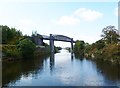
Latchford Viaduct
Once carrying the Warrington to Stockport railway line over Manchester Ship Canal. Opened 1893, line closed 1985. http://www.forgottenrelics.co.uk/bridges/gallery/latchford.html
Image: © Mike Faherty
Taken: 18 Sep 2011
0.05 miles
5

Ship passing narrow boats at the narrowest point on the Manchester Ship Canal
The flotilla of narrow boats was organised by the Inland Waterways Association to mark the Centenary of the Ship Canal.
Image: © David Long
Taken: 10 Jun 1994
0.08 miles
6
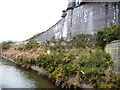
Manchester Ship Canal navigation beacon
On the north bank, immediately west of a disused railway bridge.
Image: © Christine Johnstone
Taken: 13 Apr 2013
0.08 miles
7
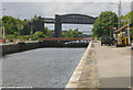
Latchford Lock, Manchester Ship Canal
Looking westwards at Latchford Lock, Warrington, towards Latchford railway bridge.
Image: © Martin Clark
Taken: Unknown
0.08 miles
8
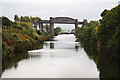
Manchester Ship Canal
View NE from Knutsford Road swing bridge towards the disused railway bridge and Latchford Locks
Image: © Richard Croft
Taken: 10 Sep 2010
0.09 miles
9

Latchford railway viaduct
The viaduct is set at a level to allow tall ships on the Manchester Ship Canal to pass beneath Image It was built in 1892. The girders are of wrought iron, with a main span of 280 feet and two side spans of 98 feet. Details at http://www.forgottenrelics.org/bridges/latchford-viaduct/. This northern side span crosses what is now the Trans Pennine Trail.
The railway that crossed the viaduct was built by the London and North Western Railway, and linked Warrington with Stockport and eventually Sheffield. Passenger services ceased in 1962, and it closed completely in 1985.
Image: © Stephen Craven
Taken: 23 Sep 2025
0.09 miles
10
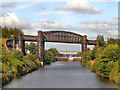
Manchester Ship Canal, Latchford Viaduct and Locks
The (now disused) viaduct at Latchford, with Latchford Locks behind. Further beyond is the Thelwall viaduct Image carrying the M6 motorway over the Ship Canal.
The view is from the Knutsford Road Swingbridge.
Image: © David Dixon
Taken: 27 Jul 2012
0.09 miles