IMAGES TAKEN NEAR TO
Kildonan Road, WARRINGTON, WA4 2LJ
Introduction
This page details the photographs taken nearby to Kildonan Road, WA4 2LJ by members of the Geograph project.
The Geograph project started in 2005 with the aim of publishing, organising and preserving representative images for every square kilometre of Great Britain, Ireland and the Isle of Man.

There are currently over 7.5m images from over14,400 individuals and you can help contribute to the project by visiting https://www.geograph.org.uk
Image Map
Images are licensed for reuse under creativecommons.org/licenses/by-sa/2.0
Notes
- Clicking on the map will re-center to the selected point.
- The higher the marker number, the further away the image location is from the centre of the postcode.
Image Listing (28 Images Found)
Images are licensed for reuse under creativecommons.org/licenses/by-sa/2.0
Image
Details
Distance
5
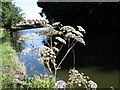
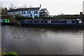
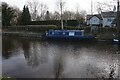
Wild Angelica - Angelica sylvestris - Bridgewater Canal, Grappenhall
Image: © Ian Hawfinch
Taken: 9 Aug 2005
0.15 miles
6
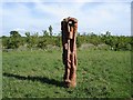
Wood sculpture in Grappenhall Wood
Grappenhall Wood was planted by the Woodland Trust a few years ago.
Image: © Ian Hawfinch
Taken: 29 May 2005
0.15 miles