IMAGES TAKEN NEAR TO
Handforth Close, WARRINGTON, WA4 2JR
Introduction
This page details the photographs taken nearby to Handforth Close, WA4 2JR by members of the Geograph project.
The Geograph project started in 2005 with the aim of publishing, organising and preserving representative images for every square kilometre of Great Britain, Ireland and the Isle of Man.

There are currently over 7.5m images from over14,400 individuals and you can help contribute to the project by visiting https://www.geograph.org.uk
Image Map
Images are licensed for reuse under creativecommons.org/licenses/by-sa/2.0
Notes
- Clicking on the map will re-center to the selected point.
- The higher the marker number, the further away the image location is from the centre of the postcode.
Image Listing (11 Images Found)
Images are licensed for reuse under creativecommons.org/licenses/by-sa/2.0
Image
Details
Distance
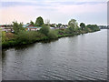
3
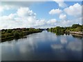
Woolston, Manchester Ship Canal
With Thelwall High Level Bridge, and chimneys at Latchford in the distance.
Image: © Mike Faherty
Taken: 18 Sep 2011
0.07 miles
4
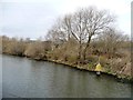
Manchester Ship Canal beacon 302
On the north bank.
Image: © Christine Johnstone
Taken: 13 Apr 2013
0.08 miles
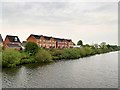
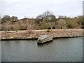
5
Western end of jetty, west of Thelwall Ferry
A place to store fallen trees on the north bank of the Manchester Ship Canal.
Image: © Christine Johnstone
Taken: 13 Apr 2013
0.09 miles
6
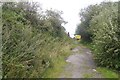
Beware of the flowers, 'cos they are gonna get yer yeh!
Track away from the Manchester Ship Canal with a hogweed warning. Looks like prime territory for the horrible weed. (the sap causes blistering in UV light - a seriously nasty plant).
Image: © Richard Webb
Taken: 11 Aug 2019
0.10 miles
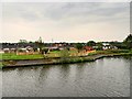
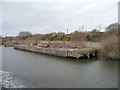
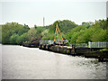
8
Dredgings jetty, west of Thelwall Ferry
Dredgings from the Manchester Ship Canal are piped out of ships and used as landfill on Warrington's Eyes.
Image: © Christine Johnstone
Taken: 13 Apr 2013
0.14 miles
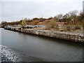
9
Manchester Ship Canal, Dredging Jetty near Thelwall
Dredgings from the Manchester Ship Canal are piped out of ships and used as landfill on Warrington's Eyes
Image: © David Dixon
Taken: 11 May 2016
0.16 miles
10
Eastern end of jetty, west of Thelwall Ferry
On the north bank of the Manchester Ship Canal.
Image: © Christine Johnstone
Taken: 13 Apr 2013
0.18 miles