IMAGES TAKEN NEAR TO
Pennant Close, WARRINGTON, WA3 6RR
Introduction
This page details the photographs taken nearby to Pennant Close, WA3 6RR by members of the Geograph project.
The Geograph project started in 2005 with the aim of publishing, organising and preserving representative images for every square kilometre of Great Britain, Ireland and the Isle of Man.

There are currently over 7.5m images from over14,400 individuals and you can help contribute to the project by visiting https://www.geograph.org.uk
Image Map
Images are licensed for reuse under creativecommons.org/licenses/by-sa/2.0
Notes
- Clicking on the map will re-center to the selected point.
- The higher the marker number, the further away the image location is from the centre of the postcode.
Image Listing (27 Images Found)
Images are licensed for reuse under creativecommons.org/licenses/by-sa/2.0
Image
Details
Distance
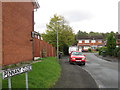
3
West end of McCarthy Close, Oakwood
One of several residential cul de sacs off Admirals Road.
Image: © Richard Vince
Taken: 12 Sep 2015
0.07 miles
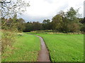
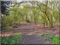
5
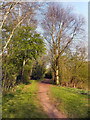
Birchwood Forest Park
Originally, this area was known as Risley. In 1939 the small farming community was transformed by the construction of Risley Royal Ordnance Factory which covered nearly 1000 acres of prime agricultural land and produced millions of bombs and shells during the Second World War.
After the war, the factory was used by the Admiralty as a storage depot until 1961. The new town of Birchwood and Birchwood Forest Park were created in the 1970s from one of the largest derelict land sites in Europe.
Image: © David Dixon
Taken: 28 Mar 2011
0.11 miles
7
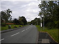
Admirals Road, Oakwood
The main distributor road through Oakwood, seen close to its eastern extremity.
Image: © Richard Vince
Taken: 12 Sep 2015
0.13 miles
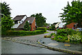
8
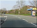
Admirals Road at the junction for Jay Close
Image: © Peter Whatley
Taken: 24 Mar 2011
0.13 miles
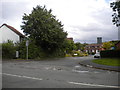
9
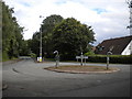
Roundabout, Admirals Road, Oakwood
At the junction with Halliday Close.
Image: © Richard Vince
Taken: 12 Sep 2015
0.14 miles
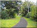
10
Birchwood Forest Park
Originally, this area was known as Risley. In 1939 the small farming community was transformed by the construction of Risley Royal Ordnance Factory which covered nearly 1000 acres of prime agricultural land and produced millions of bombs and shells during the Second World War.
After the war, the factory was used by the Admiralty as a storage depot until 1961. The new town of Birchwood and Birchwood Forest Park were created in the 1970s from one of the largest derelict land sites in Europe.
Image: © David Dixon
Taken: 28 Mar 2011
0.15 miles