IMAGES TAKEN NEAR TO
Owen Street, WARRINGTON, WA2 7PA

Introduction

This page details the photographs taken nearby to Owen Street, WA2 7PA by members of the Geograph project.

The Geograph project started in 2005 with the aim of publishing, organising and preserving representative images for every square kilometre of Great Britain, Ireland and the Isle of Man.

There are currently over 7.5m images from over14,400 individuals and you can help contribute to the project by visiting https://www.geograph.org.uk

Image Map


Images are licensed for reuse under creativecommons.org/licenses/by-sa/2.0
Notes
  • Clicking on the map will re-center to the selected point.
  • The higher the marker number, the further away the image location is from the centre of the postcode.

Image Listing (33 Images Found)

Images are licensed for reuse under creativecommons.org/licenses/by-sa/2.0
  • ...
Image
Details
Distance
1
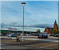
Tesco Extra Warrington
Image: © Richard Cooke Taken: 30 Sep 2013
0.09 miles
2
Tesco Extra, Warrington
In the background you can see St Anne’s Church which was acquired in December 1995 by the North West Face Climbing Centre. The doors opened to climbers on February 1st 1996. The following years have allowed more wall construction using British climbing wall manufacturers.
Image: © Matt Harrop Taken: 30 Sep 2016
0.09 miles
3
St Ann's Church
No longer in use as a church, but houses a climbing centre.
Image: © Eirian Evans Taken: 14 May 2009
0.11 miles
4
St Ann's Church (North West Face), Warrington
This church (architect John Douglas, 1869) was closed in 1995 (a new church opened in 2000, square SK6189). It now houses a rock climbing centre, the North West Face.
Image: © S Parish Taken: Unknown
0.11 miles
5
John Chorley warehouse in Dallam Lane
From West Coast main line
Image: © John Firth Taken: 18 Aug 2011
0.11 miles
6
Junction on A49
This is the junction on the A49 with Longford Street and Kerfoot Street. On three of the corners we have McDonald's, Matalan and Caledonia Motors. The Manchester-Liverpool (Cheshire Lines) avoiding line used to cross Winwick Road here on a skew bridge next to the Jockey Inn (where McDonald's is). Jockey Street is still there just north of the junction, and Kerfoot Street is named after a landlord of the Inn. (additional info provided by Steve Parish)
Image: © andy Taken: 14 Jul 2005
0.13 miles
7
Winwick Road/Longford Street junction
Image: © Colin Pyle Taken: 7 Oct 2010
0.14 miles
8
CWT
Image: © N Chadwick Taken: 10 Dec 2021
0.15 miles
9
Fast food restaurant off Winwick Road
Image: © JThomas Taken: 16 Feb 2013
0.16 miles
10
The gates to Brickfield Park
Revitalised Brickfield Park, north of Warrington city centre.
Image: © Eirian Evans Taken: 14 May 2009
0.17 miles
  • ...