IMAGES TAKEN NEAR TO
Randolph Avenue, LONDON, W9 1BJ
Introduction
This page details the photographs taken nearby to Randolph Avenue, W9 1BJ by members of the Geograph project.
The Geograph project started in 2005 with the aim of publishing, organising and preserving representative images for every square kilometre of Great Britain, Ireland and the Isle of Man.

There are currently over 7.5m images from over14,400 individuals and you can help contribute to the project by visiting https://www.geograph.org.uk
Image Map
Images are licensed for reuse under creativecommons.org/licenses/by-sa/2.0
Notes
- Clicking on the map will re-center to the selected point.
- The higher the marker number, the further away the image location is from the centre of the postcode.
Image Listing (380 Images Found)
Images are licensed for reuse under creativecommons.org/licenses/by-sa/2.0
Image
Details
Distance
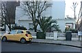
1
Slow, slow, quick, quick, slower (117)
Junction of Randolph Avenue and Clifton Road
Image: © Basher Eyre
Taken: 23 Apr 2016
0.01 miles
2

Slow, slow, quick, quick, slower (116)
Elizabeth Close
Image: © Basher Eyre
Taken: 23 Apr 2016
0.01 miles
3
Slow, slow, quick, quick, slower (115)
Houses in Randolph Avenue
Image: © Basher Eyre
Taken: 23 Apr 2016
0.02 miles
4
Slow, slow, quick, quick, slower (118)
Pedestrian crossing Clifton Road
Image: © Basher Eyre
Taken: 23 Apr 2016
0.02 miles
5
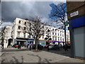
Clifton Road, W9
Looking towards Maida Vale
Image: © Danny P Robinson
Taken: 6 Aug 2006
0.03 miles
6

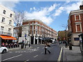
Maida Vale, W9 (1)
This road follows the course of a Roman Road, and is also the A5. The London Underground sign to the right of the shot points towards Warwick Avenue Station and has been recently restored to its original condition -- read more on this link
http://www.tfl.gov.uk/tfl/press-centre/press-releases/press-releases-content.asp?prID=827
Backing on to this view http://www.geograph.org.uk/photo/215922
Image: © Danny P Robinson
Taken: 6 Aug 2006
0.03 miles
7

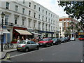
Maida Vale, W9 (2)
Looking towards Parsons House http://www.geograph.org.uk/photo/155195 and backing onto this view http://www.geograph.org.uk/photo/215917
Shortly in this direction, the road will become Edgware Road.
Image: © Danny P Robinson
Taken: 6 Aug 2006
0.03 miles
8

The Robert Browning, Maida Vale
This is one of 37 London pubs owned by Sam Smith's of Tadcaster, North Yorkshire.
Image: © Ian S
Taken: 8 Dec 2010
0.03 miles
9

The windows of the Robert Browning pub
The Robert Browning is one of 37 Sam Smith's Public Houses in the London area.
Image: © Ian S
Taken: 8 Dec 2010
0.03 miles
10
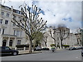
Palm plant on Randolph Avenue, Maida Vale
Image: © David Howard
Taken: 25 Jan 2021
0.03 miles