IMAGES TAKEN NEAR TO
Studland Road, LONDON, W7 3QX
Introduction
This page details the photographs taken nearby to Studland Road, W7 3QX by members of the Geograph project.
The Geograph project started in 2005 with the aim of publishing, organising and preserving representative images for every square kilometre of Great Britain, Ireland and the Isle of Man.

There are currently over 7.5m images from over14,400 individuals and you can help contribute to the project by visiting https://www.geograph.org.uk
Image Map
Images are licensed for reuse under creativecommons.org/licenses/by-sa/2.0
Notes
- Clicking on the map will re-center to the selected point.
- The higher the marker number, the further away the image location is from the centre of the postcode.
Image Listing (21 Images Found)
Images are licensed for reuse under creativecommons.org/licenses/by-sa/2.0
Image
Details
Distance
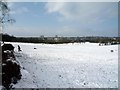
1
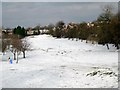
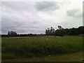
Brent Valley golf course - looking down fairway one (snow scene)
Image: © J Taylor
Taken: 3 Feb 2009
0.06 miles
2
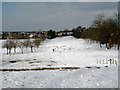
Brent Valley golf course - looking down fairway one (snow scene)
Image: © J Taylor
Taken: 3 Feb 2009
0.11 miles
3
View of St Christopher's C of E Church, Laurie Road from Brent River Park
Looking south-southeast.
Image: © Robert Lamb
Taken: 5 Jun 2012
0.11 miles
5
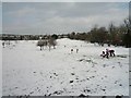
Brent Valley golf course - looking down fairway one (snow scene)
Image: © J Taylor
Taken: 3 Feb 2009
0.16 miles
6
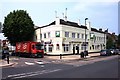
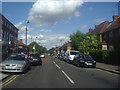
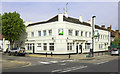
Delivering London Pride
Fullers Brewery truck outside the White Hart.
Image: © Des Blenkinsopp
Taken: 25 Jun 2013
0.17 miles
8
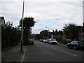
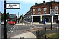
Greenford Avenue, Greenford
Looking north towards Perivale Park Golf Course.
Image: © Ray Stanton
Taken: 19 Jun 2006
0.19 miles