IMAGES TAKEN NEAR TO
Oaklands Road, LONDON, W7 2DT

Introduction

This page details the photographs taken nearby to Oaklands Road, W7 2DT by members of the Geograph project.

The Geograph project started in 2005 with the aim of publishing, organising and preserving representative images for every square kilometre of Great Britain, Ireland and the Isle of Man.

There are currently over 7.5m images from over14,400 individuals and you can help contribute to the project by visiting https://www.geograph.org.uk

Image Map


Images are licensed for reuse under creativecommons.org/licenses/by-sa/2.0
Notes
  • Clicking on the map will re-center to the selected point.
  • The higher the marker number, the further away the image location is from the centre of the postcode.

Image Listing (19 Images Found)

Images are licensed for reuse under creativecommons.org/licenses/by-sa/2.0
Image
Details
Distance
1
The Grosvenor Public House, Hanwell
Image: © PAUL FARMER Taken: 7 May 2018
0.07 miles
2
Oaklands Road from the corner of Grosvenor Road
The Grosvenor pub is on the right, something becoming rarer in the 21st century on traditional street corners, one by one they are turning into houses.
Image: © David Howard Taken: 13 Apr 2013
0.07 miles
3
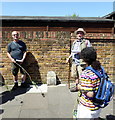
Hanwell Parish Boundary Stone
Image: © PAUL FARMER Taken: 7 May 2018
0.10 miles
4
Manton Road, Hanwell
Image: © David Howard Taken: 13 Apr 2013
0.14 miles
5
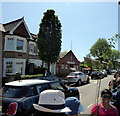
Elthorne Avenue, Hanwell
The Victorian builders were probably the only ones since the Romans to build straight roads in Britain, which they lined with almost identical terraced houses throughout the country. There were some smaller areas given grid systems in the 30s but none since then. In the last few decades developers have been banned from making new through roads without special permission, and also encouraged to build in curves.
Image: © David Howard Taken: 13 Apr 2013
0.17 miles
6
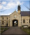
City of Westminster Cemetery chapel, Hanwell
Built c.1854 to the designs of architect Robert Jerrard. The cemetery and its buildings are Grade II listed, described at length at this https://historicengland.org.uk/listing/the-list/list-entry/1001543 .
Image: © Jim Osley Taken: 6 Feb 2015
0.18 miles
7
City of Westminster Cemetery chapel, Hanwell
Built c.1854 to the designs of architect Robert Jerrard. The cemetery and its buildings are Grade II listed, described at length at this https://historicengland.org.uk/listing/the-list/list-entry/1001543 .
Image: © Jim Osley Taken: 6 Feb 2015
0.18 miles
8
Leighton Hall, Leighton Road
Image: © PAUL FARMER Taken: 7 May 2018
0.21 miles
9
Turret on the Corner
A frequently seen feature, the house on the end of a terrace is a bit fancier than the neighbours. Corner of Coldershaw and Leighton roads.
Image: © Des Blenkinsopp Taken: 9 Nov 2017
0.21 miles
10
Elthorne Park Avenue, Hanwell
Looking south west.
Image: © David Medcalf Taken: 19 Jul 2006
0.21 miles