IMAGES TAKEN NEAR TO
Hammersmith Grove, LONDON, W6 0NE
Introduction
This page details the photographs taken nearby to Hammersmith Grove, W6 0NE by members of the Geograph project.
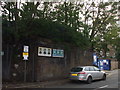
The Geograph project started in 2005 with the aim of publishing, organising and preserving representative images for every square kilometre of Great Britain, Ireland and the Isle of Man.

There are currently over 7.5m images from over14,400 individuals and you can help contribute to the project by visiting https://www.geograph.org.uk
Image Map
Images are licensed for reuse under creativecommons.org/licenses/by-sa/2.0
Notes
- Clicking on the map will re-center to the selected point.
- The higher the marker number, the further away the image location is from the centre of the postcode.
Image Listing (185 Images Found)
Images are licensed for reuse under creativecommons.org/licenses/by-sa/2.0
Image
Details
Distance
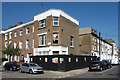
1
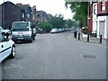
Orange Way after Wiltshire (627)
This is the junction of Adie and Overstone Roads.
Image: © Shazz
Taken: 23 Sep 2013
0.05 miles
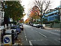
3
Corner of Kilmarsh Road
Work going on at what looks like an old corner shop.
Image: © Des Blenkinsopp
Taken: 19 Apr 2018
0.06 miles
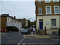
4
The Grove, Hammersmith Grove W6
At the junction with Adie Road W6
Image: © Robin Sones
Taken: 19 May 2009
0.07 miles
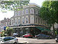
5
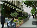
Orange Way after Wiltshire (628)
The Orange Way passes this restaurant in Hammersmith Grove.
Image: © Shazz
Taken: 23 Sep 2013
0.08 miles
6
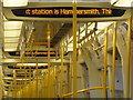
Shepherd?s Bush: the next station is Hammersmith
The caption on this Circle Line train, having left Goldhawk Road and thus shortly before reaching its terminus at Hammersmith, is repeated throughout the carriage.
Image: © Chris Downer
Taken: 7 Feb 2014
0.10 miles
7
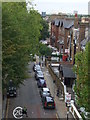
Iffley Road, W6
Taken from across the road on the 10th floor of King's Mall car park.
Image: © Phillip Perry
Taken: 7 Oct 2010
0.10 miles
8
Brackenbury Village II, W6
Where Iffley Road meets Aldensley Road & Adie Road.
Image: © Phillip Perry
Taken: 28 May 2008
0.10 miles
9
Trussley Road, W6
Trussley Road bridge abutment and embankment, part of a long forgotten railway line, but short in length that ran from Kensington (Addison Road) to Hammersmith (Grove Road), originally opened as Kensington & Richmond Railway.
Image: © Phillip Perry
Taken: 7 Oct 2010
0.11 miles
