IMAGES TAKEN NEAR TO
Gideon Mews, LONDON, W5 5EL
Introduction
This page details the photographs taken nearby to Gideon Mews, W5 5EL by members of the Geograph project.
The Geograph project started in 2005 with the aim of publishing, organising and preserving representative images for every square kilometre of Great Britain, Ireland and the Isle of Man.

There are currently over 7.5m images from over14,400 individuals and you can help contribute to the project by visiting https://www.geograph.org.uk
Image Map
Images are licensed for reuse under creativecommons.org/licenses/by-sa/2.0
Notes
- Clicking on the map will re-center to the selected point.
- The higher the marker number, the further away the image location is from the centre of the postcode.
Image Listing (163 Images Found)
Images are licensed for reuse under creativecommons.org/licenses/by-sa/2.0
Image
Details
Distance
3
![Ealing buildings [17]](https://s0.geograph.org.uk/geophotos/06/36/79/6367952_34a01332_120x120.jpg)
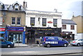
Ealing buildings [17]
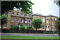
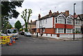
The colourfully decorated and delightful Castle Inn at number 36 St Mary's Road is a mid 19th century coaching inn which still retains in carriageway.
Ealing is one of the seven major towns in the London Borough of Ealing. A rural village until communications with London got better with the improvements to the road to Oxford (later Uxbridge Road) in the 18th century and culminating with the coming of the railway in 1838. Ealing expanded greatly with suburban development during the 19th century and became known as the "Queen of the Suburbs" due to its greenery and because it was halfway between city and country. Ealing became a municipal borough in 1901. Growth continued throughout the 20th century and Ealing became part of a modern London borough in 1965.
Image: © Michael Dibb
Taken: 14 Sep 2019
0.03 miles
5
![Ealing buildings [18]](https://s2.geograph.org.uk/geophotos/06/36/79/6367958_4230fbb4_120x120.jpg)
Ealing buildings [18]
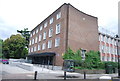
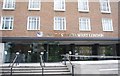
This undistinguished building is part of the University of West London. The Lady Byron School was founded in 1860 and later became Ealing College of Higher Education. In 1992, it became a university and 18 years later it was renamed the University of West London. There are campuses at Ealing, Brentford and Reading.
Ealing is one of the seven major towns in the London Borough of Ealing. A rural village until communications with London got better with the improvements to the road to Oxford (later Uxbridge Road) in the 18th century and culminating with the coming of the railway in 1838. Ealing expanded greatly with suburban development during the 19th century and became known as the "Queen of the Suburbs" due to its greenery and because it was halfway between city and country. Ealing became a municipal borough in 1901. Growth continued throughout the 20th century and Ealing became part of a modern London borough in 1965.
Image: © Michael Dibb
Taken: 14 Sep 2019
0.04 miles
7
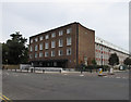
University of West London, Ealing
This was Thames Valley University and has just been renamed. It has this site in St Mary's Road, Ealing, and one in Brentford, prominently seen from the elevated M4. See its website http://www.uwl.ac.uk/.
Image: © David Hawgood
Taken: 21 Aug 2011
0.05 miles