IMAGES TAKEN NEAR TO
Sterling Place, LONDON, W5 4RB
Introduction
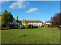
This page details the photographs taken nearby to Sterling Place, W5 4RB by members of the Geograph project.
The Geograph project started in 2005 with the aim of publishing, organising and preserving representative images for every square kilometre of Great Britain, Ireland and the Isle of Man.

There are currently over 7.5m images from over14,400 individuals and you can help contribute to the project by visiting https://www.geograph.org.uk
Image Map
Images are licensed for reuse under creativecommons.org/licenses/by-sa/2.0
Notes
- Clicking on the map will re-center to the selected point.
- The higher the marker number, the further away the image location is from the centre of the postcode.
Image Listing (37 Images Found)
Images are licensed for reuse under creativecommons.org/licenses/by-sa/2.0
Image
Details
Distance
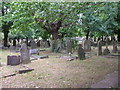
1

In South Ealing Cemetery
In the easternmost corner.
Image: © Robin Webster
Taken: 22 Sep 2012
0.06 miles
2
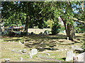
In South Ealing Cemetery
In the easternmost corner.
Image: © Robin Webster
Taken: 22 Sep 2012
0.06 miles
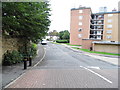
3
Lionel Road North
1930s council houses in Gunnersbury Park.
Image: © Burgess Von Thunen
Taken: 27 Nov 2012
0.10 miles
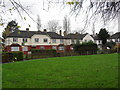
4
Brentford - Lionel Road North
Small circular green in front of terraced houses.
Image: © James Emmans
Taken: 6 Nov 2016
0.10 miles
5
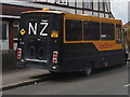
New Zealand campervan
Parked on West London streets are various campervans, ambulances and buses proudly proclaiming their New Zealand associations.
Image: © David Hawgood
Taken: 25 Mar 2008
0.12 miles
6
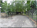
Path through South Ealing Cemetery from Occupation Lane
Image: © David Howard
Taken: 14 Sep 2013
0.13 miles
7
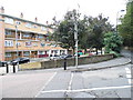
Flats on the corner of Clayponds Avenue and Occupation Lane
Image: © David Howard
Taken: 14 Sep 2013
0.13 miles
8
Park Football in Gunnersbury
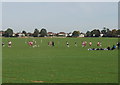
View looking North, with the houses of Pope's Lane beyond the park. The park is heavily used for organised sports. The Hounslow Leisure and Cultural Services website (http://hounslow.info/page.aspx?pointerid=D987EF95082F490480E56DD491540E52) tells us there are 2 play areas, 2 rugby pitches, 1 cricket square, 1 lacrosse pitch, 20 football pitches, 15 tennis courts, a bowling green and a pitch 'n putt golf course.
Image: © David Hawgood
Taken: 9 Oct 2005
0.14 miles