IMAGES TAKEN NEAR TO
Murray Road, LONDON, W5 4DA
Introduction
This page details the photographs taken nearby to Murray Road, W5 4DA by members of the Geograph project.
The Geograph project started in 2005 with the aim of publishing, organising and preserving representative images for every square kilometre of Great Britain, Ireland and the Isle of Man.

There are currently over 7.5m images from over14,400 individuals and you can help contribute to the project by visiting https://www.geograph.org.uk
Image Map (Loading...)


Getting Data...Please wait
Leaflet Map data © OpenStreetMap
Images are licensed for reuse under creativecommons.org/licenses/by-sa/2.0
Notes
- Clicking on the map will re-center to the selected point.
- The higher the marker number, the further away the image location is from the centre of the postcode.
Image Listing (15 Images Found)
Images are licensed for reuse under creativecommons.org/licenses/by-sa/2.0
Image
Details
Distance
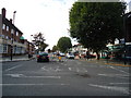
1
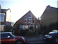
The Polish Church on Junction Road, Ealing
Image: © David Howard
Taken: 18 Apr 2015
0.11 miles
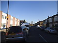
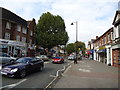
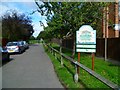
4
St Stephen House
A sort of headquarters for Hungarian Catholics in London.
Image: © Robin Webster
Taken: 22 Sep 2012
0.17 miles
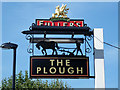
5
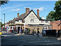
The Plough, Ealing
At the junction of the B452 and B4491.
Image: © Robin Webster
Taken: 22 Sep 2012
0.17 miles
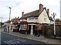
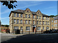
10

Roof and weather-vane, Ealing Park Tavern
A building with many interesting architectural details, some of them showing Art Nouveau influence.
Image: © Stefan Czapski
Taken: 22 Jun 2014
0.22 miles