IMAGES TAKEN NEAR TO
Ash Grove, LONDON, W5 4AU
Introduction
This page details the photographs taken nearby to Ash Grove, W5 4AU by members of the Geograph project.
The Geograph project started in 2005 with the aim of publishing, organising and preserving representative images for every square kilometre of Great Britain, Ireland and the Isle of Man.

There are currently over 7.5m images from over14,400 individuals and you can help contribute to the project by visiting https://www.geograph.org.uk
Image Map
Images are licensed for reuse under creativecommons.org/licenses/by-sa/2.0
Notes
- Clicking on the map will re-center to the selected point.
- The higher the marker number, the further away the image location is from the centre of the postcode.
Image Listing (49 Images Found)
Images are licensed for reuse under creativecommons.org/licenses/by-sa/2.0
Image
Details
Distance
1
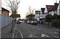
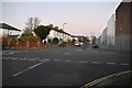
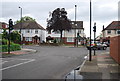
Beech Gardens, W5 - close to Gunnersbury Park
One of a number of little streets on the north side of Popes Lane that were given tree names - Sycamore, Maple, Cedar, Ash, Olive, and so on. It has to be said that there are far fewer trees here than in the 'leafy' Victorian streets further north.
Image: © Stefan Czapski
Taken: 20 Apr 2022
0.01 miles