
IMAGES TAKEN NEAR TO
Woodside Court, The Common, LONDON, W5 3JD
Introduction
This page details the photographs taken nearby to Woodside Court, The Common, W5 3JD by members of the Geograph project.
The Geograph project started in 2005 with the aim of publishing, organising and preserving representative images for every square kilometre of Great Britain, Ireland and the Isle of Man.

There are currently over 7.5m images from over14,400 individuals and you can help contribute to the project by visiting https://www.geograph.org.uk
Image Map
Images are licensed for reuse under creativecommons.org/licenses/by-sa/2.0
Notes
- Clicking on the map will re-center to the selected point.
- The higher the marker number, the further away the image location is from the centre of the postcode.
Image Listing (88 Images Found)
Images are licensed for reuse under creativecommons.org/licenses/by-sa/2.0
Image
Details
Distance
1
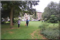
Grange Park, Ealing
Half way along Grange Park is this attractive triangle of green.
Image: © Trevor Harris
Taken: 31 Jul 2012
0.09 miles
2
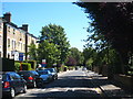
The Grove, Ealing
A pleasant tree-lined road leading to Ealing Common, which can be seen in the distance.
Image: © Rod Allday
Taken: 18 Aug 2012
0.15 miles
3
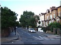
The eastern part of the street named "The Grove"
A row of residential houses with large front gardens, now used for off-street parking.
Image: © David Smith
Taken: 13 Jun 2011
0.16 miles
4
![Ealing houses [30]](https://s0.geograph.org.uk/geophotos/06/37/00/6370068_6f33a65b_120x120.jpg)
Ealing houses [30]
This long row contains numbers 6, 7, 8 and 9, The Common. Built circa 1840 with the division between the houses in the form of Doric pilasters. Listed, grade II, with details at: https://historicengland.org.uk/listing/the-list/list-entry/1358759
Ealing is one of the seven major towns in the London Borough of Ealing. A rural village until communications with London got better with the improvements to the road to Oxford (later Uxbridge Road) in the 18th century and culminating with the coming of the railway in 1838. Ealing expanded greatly with suburban development during the 19th century and became known as the "Queen of the Suburbs" due to its greenery and because it was halfway between city and country. Ealing became a municipal borough in 1901. Growth continued throughout the 20th century and Ealing became part of a modern London borough in 1965.
Image: © Michael Dibb
Taken: 14 Sep 2019
0.16 miles
5
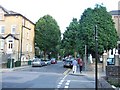
Windsor Road Ealing
Mature trees (and parked cars) line this residential street a few minutes walk from the stations.
Image: © David Smith
Taken: 13 Jun 2011
0.16 miles
6
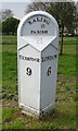
Old milepost on Uxbridge Road (A4020), Ealing Common
Inscription reads - Ealing Parish, Uxbridge 9 / London 6.
See Image] for context.
Image: © JThomas
Taken: 13 Apr 2019
0.18 miles
9
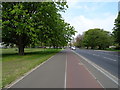
Cycle path beside Uxbridge Road (A4020), Ealing Common
Looking north west.
Image: © JThomas
Taken: 13 Apr 2019
0.18 miles
10
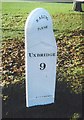
Old Milepost, A4020 (former A40), Uxbridge Road, Ealing
The milestone is located on open ground beyond the footpath on the south side of the road. Parish of Ealing (Ealing District). Cast iron post, Barrett Middlesex iron casting design, erected by the Tyburn to Uxbridge turnpike trust in the 19th century.
Inscription reads:-
UXBRIDGE / 9 : : EALING / PARISH : : LONDON / 6 : : RJ & J BARRETT / LONDON 1832
Grade II Listed, List Entry Number: 1079385 https://historicengland.org.uk/listing/the-list/list-entry/1079385
Milestone Society National ID: MX_LW06
Image: © Colin Woodward
Taken: Unknown
0.18 miles