IMAGES TAKEN NEAR TO
Lynwood Road, LONDON, W5 1JQ
Introduction
This page details the photographs taken nearby to Lynwood Road, W5 1JQ by members of the Geograph project.
The Geograph project started in 2005 with the aim of publishing, organising and preserving representative images for every square kilometre of Great Britain, Ireland and the Isle of Man.

There are currently over 7.5m images from over14,400 individuals and you can help contribute to the project by visiting https://www.geograph.org.uk
Image Map
Images are licensed for reuse under creativecommons.org/licenses/by-sa/2.0
Notes
- Clicking on the map will re-center to the selected point.
- The higher the marker number, the further away the image location is from the centre of the postcode.
Image Listing (36 Images Found)
Images are licensed for reuse under creativecommons.org/licenses/by-sa/2.0
Image
Details
Distance
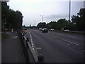
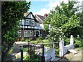
3
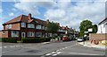
Junction of Lynwood Road with Brunswick Road, Ealing
Image: © Ruth Sharville
Taken: 22 May 2011
0.08 miles
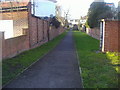
4
Path between houses on Sandall Road, Ealing
By the pass is a fenced off grass track, which usually means a water supply which has been restricted from the public. Some have notices up naming the owners as such.
Image: © David Howard
Taken: 6 Jan 2015
0.09 miles
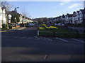
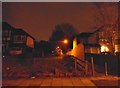
5
Path between Brunswick Road and Western Avenue
Image: © David Howard
Taken: 6 Apr 2013
0.09 miles
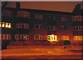
6
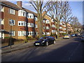
Linden Court and Brunswick Court, Brunswick Road
Image: © David Howard
Taken: 6 Apr 2013
0.09 miles
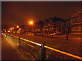
7
Houses on Western Avenue, west of Hanger Lane Underground station
Image: © Ruth Sharville
Taken: 22 May 2011
0.11 miles
8
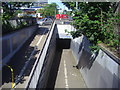
Subway under the A40 from Lynwood Road, Ealing
Image: © David Howard
Taken: 2 Jun 2009
0.12 miles