IMAGES TAKEN NEAR TO
St. Albans Avenue, LONDON, W4 5LL
Introduction
This page details the photographs taken nearby to St. Albans Avenue, W4 5LL by members of the Geograph project.
The Geograph project started in 2005 with the aim of publishing, organising and preserving representative images for every square kilometre of Great Britain, Ireland and the Isle of Man.

There are currently over 7.5m images from over14,400 individuals and you can help contribute to the project by visiting https://www.geograph.org.uk
Image Map
Images are licensed for reuse under creativecommons.org/licenses/by-sa/2.0
Notes
- Clicking on the map will re-center to the selected point.
- The higher the marker number, the further away the image location is from the centre of the postcode.
Image Listing (180 Images Found)
Images are licensed for reuse under creativecommons.org/licenses/by-sa/2.0
Image
Details
Distance
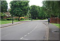
2
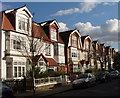
Rusthall Avenue, Chiswick
This is just outside Bedford Park, and one of these houses has a Bedford Park Society plaque commemorating the architect and conservationist Beryl Brownsword - see Image
Image: © David Hawgood
Taken: 2 Mar 2009
0.06 miles
3
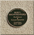
Plaque commemorating Beryl Brownsword, Bedford Park conservationist
The plaque in Rusthall Avenue is worded:
Bedford Park Society
Beryl Brownsword, Architect & Conservationist, lived here 1922-2007
See Bedford Park Society website http://www.bedfordpark.org/ , also http://www.chiswickw4.com/default.asp?section=info&page=evbedfordparksociety04.htm . For a view of the row of houses see Image
Image: © David Hawgood
Taken: 2 Mar 2009
0.06 miles
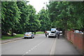
6
Wadhurst Road, Bedford Park
Described as the world's first garden suburb, Bedford Park was designed by Norman Shaw in the 1870s. As is so often the case now it is difficult to obtain photographs without parked cars in developments which were never designed with cars in mind, but at least there were only a couple in view in this photograph looking along Wadhurst Road to the end of Priory Road.
Image: © Marathon
Taken: 4 May 2011
0.07 miles
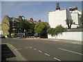
8
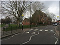
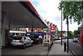
South Parade Acton Green
South Parade Acton Green by St Alban's Church
Image: © Shaun Ferguson
Taken: 3 Mar 2009
0.08 miles
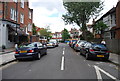
9
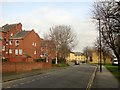
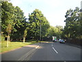
Beaconsfield Road, Acton
The B490 north of Acton Green, with housing fronting onto Clement Close on the left.
Image: © Derek Harper
Taken: 21 Mar 2013
0.08 miles