IMAGES TAKEN NEAR TO
Chiswick High Road, LONDON, W4 4HS
Introduction
This page details the photographs taken nearby to Chiswick High Road, W4 4HS by members of the Geograph project.
The Geograph project started in 2005 with the aim of publishing, organising and preserving representative images for every square kilometre of Great Britain, Ireland and the Isle of Man.

There are currently over 7.5m images from over14,400 individuals and you can help contribute to the project by visiting https://www.geograph.org.uk
Image Map
Images are licensed for reuse under creativecommons.org/licenses/by-sa/2.0
Notes
- Clicking on the map will re-center to the selected point.
- The higher the marker number, the further away the image location is from the centre of the postcode.
Image Listing (253 Images Found)
Images are licensed for reuse under creativecommons.org/licenses/by-sa/2.0
Image
Details
Distance
7
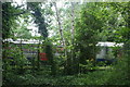
View of two District line trains passing the Gunnersbury Triangle Nature Reserve
Looking south-southeast.
Image: © Robert Lamb
Taken: 12 May 2018
0.06 miles
8
Arlington Gardens, Chiswick
View from the end near Turnham Green.
Image: © David Hawgood
Taken: 2 Mar 2009
0.06 miles
9
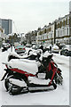
Arlington Gardens in the snow
The road gets its name from Arlington House, on the estate of which the street was developed.
Image: © Alan Murray-Rust
Taken: 19 Dec 2010
0.06 miles
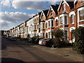
10
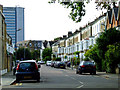
Arlington Gardens
With the BSI (British Standards Institution) Building in the distance.
Image: © Thomas Nugent
Taken: 9 Oct 2011
0.06 miles