IMAGES TAKEN NEAR TO
Bollo Bridge Road, LONDON, W3 8AX
Introduction
This page details the photographs taken nearby to Bollo Bridge Road, W3 8AX by members of the Geograph project.
The Geograph project started in 2005 with the aim of publishing, organising and preserving representative images for every square kilometre of Great Britain, Ireland and the Isle of Man.

There are currently over 7.5m images from over14,400 individuals and you can help contribute to the project by visiting https://www.geograph.org.uk
Image Map
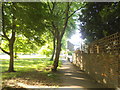
Images are licensed for reuse under creativecommons.org/licenses/by-sa/2.0
Notes
- Clicking on the map will re-center to the selected point.
- The higher the marker number, the further away the image location is from the centre of the postcode.
Image Listing (129 Images Found)
Images are licensed for reuse under creativecommons.org/licenses/by-sa/2.0
Image
Details
Distance
1
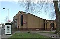
All Saints Church Centre, Bollo Bridge Road, London W3
Image: © John Salmon
Taken: 5 Feb 2003
0.01 miles
2
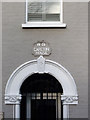
Carlton House detail
Detail of the house seen here http://www.geograph.org.uk/photo/2765817
Image: © Alan Murray-Rust
Taken: 10 Jan 2012
0.02 miles
3
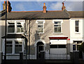
Carlton House, Bollo Bridge Road
Not entirely typical of the houses in this street, it has a wider frontage. The house fronted a small works, possibly one of the many laundries in the area, which would have been accessed through an arch now replaced by the right hand window. The result was deemed worthy of an individual name for the property.
Now converted to offices.
See http://www.geograph.org.uk/photo/2765811 for detail.
Image: © Alan Murray-Rust
Taken: 10 Jan 2012
0.02 miles
4
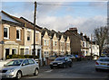
Ramsay Road, Acton
Late Victorian terraced housing off Acton Lane.
Image: © Alan Murray-Rust
Taken: 10 Jan 2012
0.04 miles
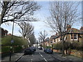
5
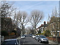
Newton Avenue, South Acton
Row of houses, as seen as from Bollo Bridge Road.
Image: © David Anstiss
Taken: 14 Apr 2013
0.04 miles
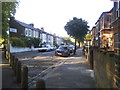
6
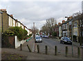
Bollo Bridge Road
Modern infill housing between Victorian terraced houses.
Image: © Alan Murray-Rust
Taken: 10 Jan 2012
0.04 miles
7
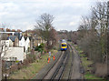
Overground to Stratford
Taken from Church Path footbridge. Due to the high parapet http://www.geograph.org.uk/photo/2642871 (which even I cannot see over!), this was point and hope, but the picture has come out far better than I had hoped.
Image: © Alan Murray-Rust
Taken: 10 Jan 2012
0.06 miles
9
Brouncker Road, South Acton
Row of houses, as seen as from Bollo Bridge Road.
Image: © David Anstiss
Taken: 14 Apr 2013
0.07 miles