IMAGES TAKEN NEAR TO
Messaline Avenue, LONDON, W3 6JY
Introduction
This page details the photographs taken nearby to Messaline Avenue, W3 6JY by members of the Geograph project.
The Geograph project started in 2005 with the aim of publishing, organising and preserving representative images for every square kilometre of Great Britain, Ireland and the Isle of Man.

There are currently over 7.5m images from over14,400 individuals and you can help contribute to the project by visiting https://www.geograph.org.uk
Image Map
Images are licensed for reuse under creativecommons.org/licenses/by-sa/2.0
Notes
- Clicking on the map will re-center to the selected point.
- The higher the marker number, the further away the image location is from the centre of the postcode.
Image Listing (105 Images Found)
Images are licensed for reuse under creativecommons.org/licenses/by-sa/2.0
Image
Details
Distance
1
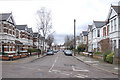
Junction of Grasmere Avenue and Messaline Avenue, Acton, W3
View facing Grasmere Avenue.
Image: © MrC
Taken: 3 Mar 2009
0.02 miles
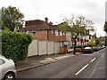
2
Junction of Grafton Road and Baldwyn Gardens, Acton, W3
View facing Grafton Road.
Image: © MrC
Taken: 3 Mar 2009
0.05 miles
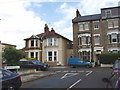
3

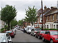
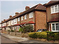
Semi-detached houses, Messaline Avenue, Acton
The houses are in pairs with narrow alleyways from street to back gardens. This style of house was built in the 1920s and 1930s. Streets often have a mixture of terraced and semi-detached houses built at the same period.
Image: © David Hawgood
Taken: 15 Sep 2006
0.05 miles
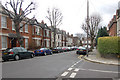
4
Allison Road, North Acton
View from Brougham Road to houses in Allison Road
Image: © David Hawgood
Taken: 20 May 2006
0.08 miles
5
Allison Road, North Acton
View of the end of Allison Road, past the end of Brougham Road
Image: © David Hawgood
Taken: 20 May 2006
0.08 miles
6
Brougham Road, North Acton
View down the road, across Horn Lane and to Lynton Road opposite
Image: © David Hawgood
Taken: 20 May 2006
0.08 miles
7
Faraday Road, Acton
View from Allison Road of the south side of Faraday Road
Image: © David Hawgood
Taken: 20 May 2006
0.09 miles
8
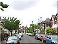
Westbourne Avenue, Acton
View along the road with Emmanuel Avenue at the end.
Image: © David Hawgood
Taken: 20 May 2006
0.10 miles
9
Emanuel Avenue with bicycle contra-flow track.
The western section of Emanuel Avenue is a one way street for motor vehicles, but has a cycle lane the other way. The bollard has a bike symbol, the cycle track surface is coloured green with a bike symbol on it.
Image: © David Hawgood
Taken: 15 Sep 2006
0.10 miles
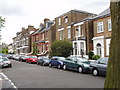
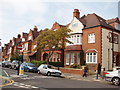
10
Terraced houses, Eastbourne Avenue, Acton
These were probably built in the 1920s or 1930s.
Image: © David Hawgood
Taken: 15 Sep 2006
0.10 miles