IMAGES TAKEN NEAR TO
Hoopers Mews, LONDON, W3 6GT
Introduction
This page details the photographs taken nearby to Hoopers Mews, W3 6GT by members of the Geograph project.
The Geograph project started in 2005 with the aim of publishing, organising and preserving representative images for every square kilometre of Great Britain, Ireland and the Isle of Man.

There are currently over 7.5m images from over14,400 individuals and you can help contribute to the project by visiting https://www.geograph.org.uk
Image Map
Images are licensed for reuse under creativecommons.org/licenses/by-sa/2.0
Notes
- Clicking on the map will re-center to the selected point.
- The higher the marker number, the further away the image location is from the centre of the postcode.
Image Listing (241 Images Found)
Images are licensed for reuse under creativecommons.org/licenses/by-sa/2.0
Image
Details
Distance
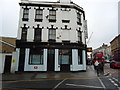
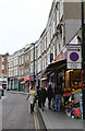
3
Market Place, Acton
The Sheepwalk pub on the right was originally the William IV.
Image: © Alan Murray-Rust
Taken: 10 Jan 2012
0.03 miles
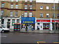
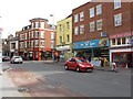
4
Market Place, Acton
A curving side street connecting High Street with Churchfield Road.
Image: © Martin Addison
Taken: 31 Oct 2013
0.03 miles
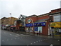
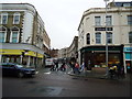
7
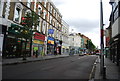
Acton High Street - Church Road junction
Image: © Peter Whatley
Taken: 6 Apr 2010
0.03 miles
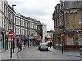
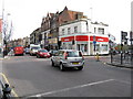
9
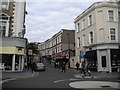
South end of Market Place, Acton
Seen from High Street.
Image: © Richard Vince
Taken: 23 Sep 2017
0.04 miles