IMAGES TAKEN NEAR TO
Denbigh Road, LONDON, W13 8NH
Introduction
This page details the photographs taken nearby to Denbigh Road, W13 8NH by members of the Geograph project.
The Geograph project started in 2005 with the aim of publishing, organising and preserving representative images for every square kilometre of Great Britain, Ireland and the Isle of Man.

There are currently over 7.5m images from over14,400 individuals and you can help contribute to the project by visiting https://www.geograph.org.uk
Image Map (Loading...)


Getting Data...Please wait
Leaflet Map data © OpenStreetMap
Images are licensed for reuse under creativecommons.org/licenses/by-sa/2.0
Notes
- Clicking on the map will re-center to the selected point.
- The higher the marker number, the further away the image location is from the centre of the postcode.
Image Listing (53 Images Found)
Images are licensed for reuse under creativecommons.org/licenses/by-sa/2.0
Image
Details
Distance
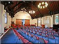
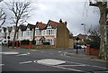
1
Houses on Montague Road at Bradley Gardens junction
Image: © Roger Templeman
Taken: 16 Nov 2015
0.04 miles
3
![Ealing features [1]](https://s1.geograph.org.uk/geophotos/06/36/55/6365565_48aaac97_120x120.jpg)
Ealing features [1]
The banner on the hedge outside the Notting Hill and Ealing High School - Junior Department proudly declares that the school was the Sunday Times' 'Independent Preparatoty School of the Year'.
Ealing is one of the seven major towns in the London Borough of Ealing. A rural village until communications with London got better with the improvements to the road to Oxford (later Uxbridge Road) in the 18th century and culminating with the coming of the railway in 1838. Ealing expanded greatly with suburban development during the 19th century and became known as the "Queen of the Suburbs" due to its greenery and because it was halfway between city and country. Ealing became a municipal borough in 1901. Growth continued throughout the 20th century and Ealing became part of a modern London borough in 1965.
Image: © Michael Dibb
Taken: 14 Sep 2019
0.12 miles
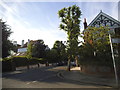
4
![Ealing houses [38]](https://s0.geograph.org.uk/geophotos/06/37/07/6370756_0f946353_120x120.jpg)
Ealing houses [38]
Homefield Lodge was originally the stables and later the coach house to Homefield, a substantial Georgian mansion with large grounds. Like others of its ilk it has been swept away for modern housing.
Ealing is one of the seven major towns in the London Borough of Ealing. A rural village until communications with London got better with the improvements to the road to Oxford (later Uxbridge Road) in the 18th century and culminating with the coming of the railway in 1838. Ealing expanded greatly with suburban development during the 19th century and became known as the "Queen of the Suburbs" due to its greenery and because it was halfway between city and country. Ealing became a municipal borough in 1901. Growth continued throughout the 20th century and Ealing became part of a modern London borough in 1965.
Image: © Michael Dibb
Taken: 14 Sep 2019
0.12 miles
5
![Ealing buildings [1]](https://s0.geograph.org.uk/geophotos/06/36/55/6365564_31b25f65_120x120.jpg)
Ealing buildings [1]
The entrance to the Notting Hill and Ealing High School - Junior Department.
Ealing is one of the seven major towns in the London Borough of Ealing. A rural village until communications with London got better with the improvements to the road to Oxford (later Uxbridge Road) in the 18th century and culminating with the coming of the railway in 1838. Ealing expanded greatly with suburban development during the 19th century and became known as the "Queen of the Suburbs" due to its greenery and because it was halfway between city and country. Ealing became a municipal borough in 1901. Growth continued throughout the 20th century and Ealing became part of a modern London borough in 1965.
Image: © Michael Dibb
Taken: 14 Sep 2019
0.13 miles

7
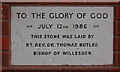
St Stephen Church Centre - Foundation stone
Image: © John Salmon
Taken: 29 Mar 2011
0.15 miles
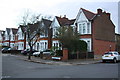
9
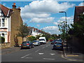
Bradley Gardens, West Ealing
Bradley Gardens is a residential street in West Ealing, in the suburbs of west London.
Image: © Malc McDonald
Taken: 2 Jun 2018
0.16 miles