IMAGES TAKEN NEAR TO
Royle Crescent, LONDON, W13 0BH
Introduction
This page details the photographs taken nearby to Royle Crescent, W13 0BH by members of the Geograph project.
The Geograph project started in 2005 with the aim of publishing, organising and preserving representative images for every square kilometre of Great Britain, Ireland and the Isle of Man.

There are currently over 7.5m images from over14,400 individuals and you can help contribute to the project by visiting https://www.geograph.org.uk
Image Map
Images are licensed for reuse under creativecommons.org/licenses/by-sa/2.0
Notes
- Clicking on the map will re-center to the selected point.
- The higher the marker number, the further away the image location is from the centre of the postcode.
Image Listing (63 Images Found)
Images are licensed for reuse under creativecommons.org/licenses/by-sa/2.0
Image
Details
Distance
7
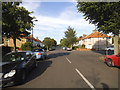
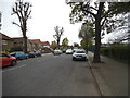
Crossway at the junction of Avalon Road
Image: © David Howard
Taken: 4 Jul 2015
0.11 miles
8
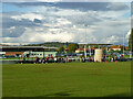
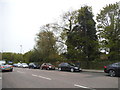
Activity at Ealing Trailfinders Rugby Club
It appears to be mini rugby, probably training.
Image: © Robin Webster
Taken: 13 Oct 2012
0.11 miles