IMAGES TAKEN NEAR TO
Percy Road, LONDON, W12 9QH
Introduction
This page details the photographs taken nearby to Percy Road, W12 9QH by members of the Geograph project.
The Geograph project started in 2005 with the aim of publishing, organising and preserving representative images for every square kilometre of Great Britain, Ireland and the Isle of Man.

There are currently over 7.5m images from over14,400 individuals and you can help contribute to the project by visiting https://www.geograph.org.uk
Image Map
Images are licensed for reuse under creativecommons.org/licenses/by-sa/2.0
Notes
- Clicking on the map will re-center to the selected point.
- The higher the marker number, the further away the image location is from the centre of the postcode.
Image Listing (153 Images Found)
Images are licensed for reuse under creativecommons.org/licenses/by-sa/2.0
Image
Details
Distance
1
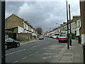
Haydn Park Road, W12
At the junction with Percy Road.
Image: © Phillip Perry
Taken: 29 Feb 2008
0.01 miles
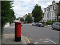
2
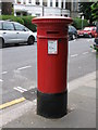
"Anonymous" (Victorian) postbox, Percy Road, W14
The position of the posting aperture dates this postbox to 1883-87.
Image: © Mike Quinn
Taken: 25 Jun 2008
0.02 miles
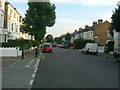
3
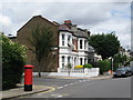
Percy Road / Roxwell Road, W14
Shows the location of Image
Image: © Mike Quinn
Taken: 25 Jun 2008
0.03 miles
4
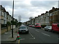
Percy Road, W12
Looking towards Uxbridge Road.
Image: © Phillip Perry
Taken: 29 Feb 2008
0.05 miles
6
Percy/Findon Road, W12
The junction of Percy Road and Findon Road, W12.
Image: © Phillip Perry
Taken: 8 Jun 2008
0.09 miles
7

Findon Road
Findon Road passing Ellingham Road
Image: © Shaun Ferguson
Taken: 3 Mar 2009
0.09 miles
9
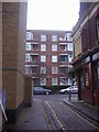
Lycett Place looking towards Becklow Road
Image: © David Howard
Taken: 14 Feb 2010
0.12 miles
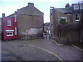
10
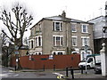
Derelict house Boscombe Road
At junction of Findon Road.
Image: © Oast House Archive
Taken: 26 Feb 2015
0.12 miles