IMAGES TAKEN NEAR TO
Bryony Road, LONDON, W12 0SP
Introduction
This page details the photographs taken nearby to Bryony Road, W12 0SP by members of the Geograph project.
The Geograph project started in 2005 with the aim of publishing, organising and preserving representative images for every square kilometre of Great Britain, Ireland and the Isle of Man.

There are currently over 7.5m images from over14,400 individuals and you can help contribute to the project by visiting https://www.geograph.org.uk
Image Map
Images are licensed for reuse under creativecommons.org/licenses/by-sa/2.0
Notes
- Clicking on the map will re-center to the selected point.
- The higher the marker number, the further away the image location is from the centre of the postcode.
Image Listing (123 Images Found)
Images are licensed for reuse under creativecommons.org/licenses/by-sa/2.0
Image
Details
Distance
2
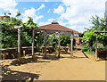
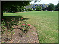
Phoenix Farm picnic and teaching area, White City
The picnic tables under a circular pergola with grape vines are the only space in the 1-acre farm not cultivated for vegetables, fruit, and small farm animals. The farm was open as part of London Squares Open Garden weekend.
Image: © David Hawgood
Taken: 11 Jun 2022
0.03 miles
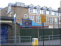
3
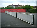
Tennis Courts, Wormholt Park, W12
The white things are supposed to be nets, well they are only they're permanently rooted to the spot. I suppose it saves the local hoodies from stealing them...........
Image: © Phillip Perry
Taken: 18 Jun 2008
0.04 miles
4
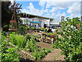
Phoenix Farm, urban community farm, White City
The 1-acre farm was open as part of London Square Open Gardens Weekend. It is next to Phoenix Fitness Centre and Janet Adegoke Swimming Pool, seen beyond the planting area. It is a community farm and educational farm, the site is packed with fruit and vegetable beds.
Image: © David Hawgood
Taken: 11 Jun 2022
0.05 miles
5
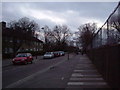
Erica Street, W12
Looking towards Wormholt Park, Erica Street outside Phoenix High School.
Image: © Phillip Perry
Taken: 7 Feb 2008
0.05 miles
6
Wormholt Park
The land now covered by Wormholt Park belonged to the estate of Wormholt Farm or Old Oak Farm in the 1850s and a field called Barn Field corresponded roughly to the park's present site. The flats in the distance are in Bloemfontein Road.
Image: © Marathon
Taken: 23 Jul 2014
0.05 miles
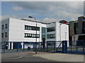
9
Cranston Court White City from Wormholt Park
The block lies between the park and Bloemfontein Road.
Image: © David Hawgood
Taken: 11 Jun 2022
0.06 miles
10
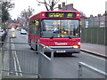
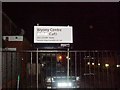
Route 283 - London Bus, Bryony Road
A Route 283 London Bus in Bryony Road heading towards Bloemfontein Road.
Terminating at East Acton (Brunel Road).
Image: © Phillip Perry
Taken: 7 Feb 2008
0.07 miles