1
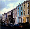
Elgin Crescent
Image: © Lauren
Taken: 15 Dec 2012
0.04 miles
2
Benchmark on Flat #86 of Nottingwood House
Ordnance Survey cut mark benchmark described on the Bench Mark Database at http://www.bench-marks.org.uk/bm41876
Image: © Roger Templeman
Taken: 10 Mar 2012
0.04 miles
3
Nottingwood House, Clarendon Road
There is an OS benchmark
Image on the front left corner of the building which is at the junction with Portland Road
Image: © Roger Templeman
Taken: 10 Mar 2012
0.04 miles
4
Walmer Yard Open House, courtyard and house 2
The Open House Festival https://programme.openhouse.org.uk/listings/189 tells us:
"Forming a discreet and private set of four interlocking houses set around an open courtyard, Walmer Yard is Peter Salter's only UK project. The houses now form the home of the Baylight Foundation."
Image: © David Hawgood
Taken: 16 Sep 2023
0.04 miles
5
Walmer Yard Open House, view to Winterbourne House
Winterbourne House is the tall block on the left. For a description see the Wikipedia entry for Portland Road https://en.wikipedia.org/wiki/Portland_Road,_Notting_Hill which describes it as built after slum clearance. Houses on the right are in Walmer Road.
Image: © David Hawgood
Taken: 16 Sep 2023
0.04 miles
6
Roof of Walmer Courtyard, view from Walmer Yard
Walmer Courtyard is a set of small business units, offices and studios. Photo from roof during open day.
Image: © David Hawgood
Taken: 16 Sep 2023
0.05 miles
7
Street frontage of Walmer Courtyard and Walmer Yard
The large window with gate beneath is Walmer Courtyard, small business units. Beyond it, lighter colour, are two of the four houses of Walmer Yard. Photo taken during Open House Festival.
Image: © David Hawgood
Taken: 16 Sep 2023
0.05 miles
8
Walmer Yard Open House, rooftop view to Eastry House
Eastry House is Walmer Road Health Centre. The view includes the top of Grenfell Tower.
Image: © David Hawgood
Taken: 16 Sep 2023
0.06 miles
9
Montpelier Garden, Notting Hill
One of a series of shared private gardens in this area.
Image: © Robin Webster
Taken: 27 Mar 2011
0.08 miles
10
Block of flats in Runcorn Place, London
Image: © PAUL FARMER
Taken: 27 Oct 2011
0.08 miles


