1
Benchmark on Ladbroke Grove face of Galsworthy House
Ordnance Survey cut mark benchmark described on the Bench Mark Database at http://www.bench-marks.org.uk/bm38035
Image: © Roger Templeman
Taken: 20 May 2011
0.03 miles
2
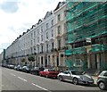
Ladbroke Grove
Looking south from the junction with Elgin Crescent
Image: © David Howard
Taken: 19 Jul 2008
0.03 miles
3
Lansdowne and Elgin Crescent Gardens
Communal garden with local adults relaxing and children playing. Participating in Open Squares Weekend when this photo was taken.
Image: © David Hawgood
Taken: 8 Jun 2008
0.05 miles
4
Arundel Gardens London W11
Houses on the north side of Arundel Gardens viewed
from Kensington Park Road looking towards Ladbroke Grove.
The street name sign shows The Royal Borough of Kensington and Chelsea.
Image: © Jaggery
Taken: 13 May 2012
0.05 miles
5
Arundel Gardens
Off Ladbroke Grove, Notting Hill, where it seems like most of London is undergoing restoration or having the basement extended.
Image: © Peter Barr
Taken: 23 Feb 2015
0.06 miles
6
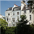
Blenheim Crescent houses from communal garden
View from Blenheim and Elgin Crescent Garden. The houses in both those roads have access to the communal garden through small back gardens. Public access during Open Squares Weekend was through a narrow passage between two houses.
Image: © David Hawgood
Taken: 8 Jun 2008
0.07 miles
7
Blenheim and Elgin Crescent Garden
A large communal garden completely hidden from the road behind the houses in both adjacent roads.
Image: © David Hawgood
Taken: 8 Jun 2008
0.07 miles
8
Arundel Gardens, Notting Hill
During the Notting Hill Carnival 2006.
Image: © Oast House Archive
Taken: 28 Aug 2006
0.08 miles
9
Street sign, Blenheim Crescent W11
Image: © Robin Sones
Taken: 16 Feb 2013
0.08 miles
10
Ladbroke Grove, Notting Hill
Ladbroke Gardens is the road on the right. See https://www.youtube.com/watch?v=rNL4Qy79MpM for a video.
Image: © Hamish Griffin
Taken: 11 May 2018
0.10 miles


