IMAGES TAKEN NEAR TO
Lancaster Road, LONDON, W11 1QJ
Introduction
This page details the photographs taken nearby to Lancaster Road, W11 1QJ by members of the Geograph project.
The Geograph project started in 2005 with the aim of publishing, organising and preserving representative images for every square kilometre of Great Britain, Ireland and the Isle of Man.

There are currently over 7.5m images from over14,400 individuals and you can help contribute to the project by visiting https://www.geograph.org.uk
Image Map
Images are licensed for reuse under creativecommons.org/licenses/by-sa/2.0
Notes
- Clicking on the map will re-center to the selected point.
- The higher the marker number, the further away the image location is from the centre of the postcode.
Image Listing (263 Images Found)
Images are licensed for reuse under creativecommons.org/licenses/by-sa/2.0
Image
Details
Distance
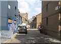
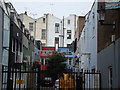
5
Dunworth Mews, off Portobello Road
Looking east-northeast.
Image: © Robert Lamb
Taken: 20 Nov 2010
0.02 miles
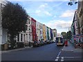
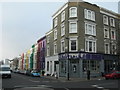
7
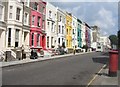
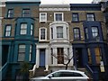
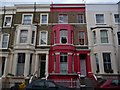
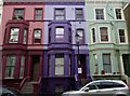
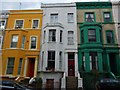
Colourful houses - Lancaster Road
Somehow the residents of this stretch had managed to keep their road frontage closed to visitors during the Notting Hill Carnival - 2013.
Image: © Fernweh
Taken: 25 Aug 2013
0.02 miles
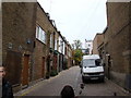
9
Alba Place, off Portobello Road
Looking east-northeast.
Image: © Robert Lamb
Taken: 20 Nov 2010
0.03 miles
10
Lancaster Road, W11
At the junction of All Saints Road.
Image: © Danny P Robinson
Taken: 4 Feb 2007
0.03 miles