IMAGES TAKEN NEAR TO
Tavistock Road, LONDON, W11 1AT
Introduction
This page details the photographs taken nearby to Tavistock Road, W11 1AT by members of the Geograph project.
The Geograph project started in 2005 with the aim of publishing, organising and preserving representative images for every square kilometre of Great Britain, Ireland and the Isle of Man.

There are currently over 7.5m images from over14,400 individuals and you can help contribute to the project by visiting https://www.geograph.org.uk
Image Map
Images are licensed for reuse under creativecommons.org/licenses/by-sa/2.0
Notes
- Clicking on the map will re-center to the selected point.
- The higher the marker number, the further away the image location is from the centre of the postcode.
Image Listing (334 Images Found)
Images are licensed for reuse under creativecommons.org/licenses/by-sa/2.0
Image
Details
Distance
3
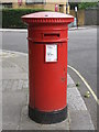
"Anonymous" (Victorian) postbox, Tavistock Road / Tavistock Crescent, W11
The low posting aperture dates this box to 1883-87.
Image: © Mike Quinn
Taken: 25 Jun 2008
0.03 miles
4
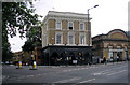
The'Metropolitan', Westbourne Park
At the junction of Tavistock Road with Great Western Road. It amazes me why so many public houses are painted black. I can think of no surer way to deter custom.
Image: © Dr Neil Clifton
Taken: 26 Jul 2008
0.03 miles
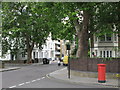
5
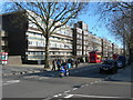
Great Western Road, W11
Near the junction of Tavistock Road, showing housing on the Brunel Estate.
Image: © Danny P Robinson
Taken: 11 Mar 2007
0.04 miles
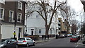
6

Tavistock Crescent, W11
Shows the location of Image
Image: © Mike Quinn
Taken: 25 Jun 2008
0.04 miles
8
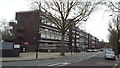
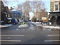
Tavistock Road, Westbourne Park
Tavistock Road looking east, to the T-junction with Great Western Road. In the background is a concrete flyover built in the 1960s, which carries the A40 trunk road into Central London.
Image: © Malc McDonald
Taken: 23 Feb 2014
0.05 miles
9
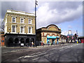
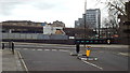
The Station & The Metropolitan
The line between Paddington and Hammersmith, including Westbourne Park station, was opened in 1864 by the Metropolitan Railway.
It retained its status as a branch of the Metropolitan line until 1990 when it was re-branded as part of the Hammersmith & City Line. (Info. Wiki. http://en.wikipedia.org/wiki/Hammersmith_%26_City_line )
The pub stuck with the old name.
Image: © Des Blenkinsopp
Taken: 7 Apr 2014
0.05 miles