IMAGES TAKEN NEAR TO
Shelley Lane, UXBRIDGE, UB9 6HP
Introduction
This page details the photographs taken nearby to Shelley Lane, UB9 6HP by members of the Geograph project.
The Geograph project started in 2005 with the aim of publishing, organising and preserving representative images for every square kilometre of Great Britain, Ireland and the Isle of Man.

There are currently over 7.5m images from over14,400 individuals and you can help contribute to the project by visiting https://www.geograph.org.uk
Image Map
Images are licensed for reuse under creativecommons.org/licenses/by-sa/2.0
Notes
- Clicking on the map will re-center to the selected point.
- The higher the marker number, the further away the image location is from the centre of the postcode.
Image Listing (131 Images Found)
Images are licensed for reuse under creativecommons.org/licenses/by-sa/2.0
Image
Details
Distance
1
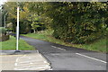
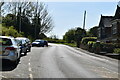
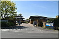
Barrington Drive, Harefield
Barrington Drive is a modern housing development in Harefield, on the outer fringe of Greater London.
Image: © Malc McDonald
Taken: 8 Sep 2013
0.03 miles
8
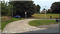
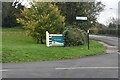
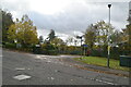
Bus terminus, Harefield West
The bus terminus at Harefield West, on the outer fringe of North West London. It is now used as a turning point, rather than a terminus. Buses turn back here whilst on their way to and from the nearby Harefield Hospital.
Image: © Malc McDonald
Taken: 8 Sep 2013
0.07 miles