IMAGES TAKEN NEAR TO
Park Lane, UXBRIDGE, UB9 6HH
Introduction
This page details the photographs taken nearby to Park Lane, UB9 6HH by members of the Geograph project.
The Geograph project started in 2005 with the aim of publishing, organising and preserving representative images for every square kilometre of Great Britain, Ireland and the Isle of Man.

There are currently over 7.5m images from over14,400 individuals and you can help contribute to the project by visiting https://www.geograph.org.uk
Image Map
Images are licensed for reuse under creativecommons.org/licenses/by-sa/2.0
Notes
- Clicking on the map will re-center to the selected point.
- The higher the marker number, the further away the image location is from the centre of the postcode.
Image Listing (66 Images Found)
Images are licensed for reuse under creativecommons.org/licenses/by-sa/2.0
Image
Details
Distance
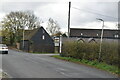
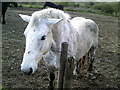
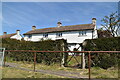
5
Park Lane, Harefield
Harefield is a village on the outer edge of Greater London.
Image: © Malc McDonald
Taken: 8 Sep 2013
0.03 miles
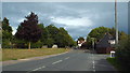
9
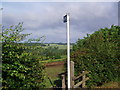
Footpath to the Grand Union Canal
The ground rising in the far distance is towards Chalfont St Peter on the other side of the M25.
Image: © Bikeboy
Taken: 23 Jun 2012
0.07 miles