IMAGES TAKEN NEAR TO
Station Parade, UXBRIDGE, UB9 5ET
Introduction
This page details the photographs taken nearby to Station Parade, UB9 5ET by members of the Geograph project.
The Geograph project started in 2005 with the aim of publishing, organising and preserving representative images for every square kilometre of Great Britain, Ireland and the Isle of Man.

There are currently over 7.5m images from over14,400 individuals and you can help contribute to the project by visiting https://www.geograph.org.uk
Image Map
Images are licensed for reuse under creativecommons.org/licenses/by-sa/2.0
Notes
- Clicking on the map will re-center to the selected point.
- The higher the marker number, the further away the image location is from the centre of the postcode.
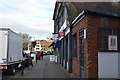
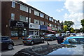
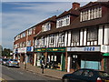
Image Listing (163 Images Found)
Images are licensed for reuse under creativecommons.org/licenses/by-sa/2.0
Image
Details
Distance
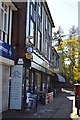

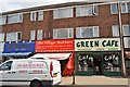
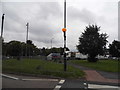
7
Denham Green shops
These shops are by Denham Station
Image: © David Hawgood
Taken: 19 Jun 2005
0.01 miles
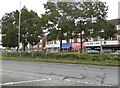
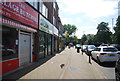
10
Moorfield Road looking towards the A412, Denham
The A412 was the nearest thing London had to the M25 before it was built, making up a small corner close to where it was built between Denham and the other side of Watford.
Image: © David Howard
Taken: 26 Aug 2014
0.02 miles