IMAGES TAKEN NEAR TO
Oldfield Lane South, GREENFORD, UB6 9JU

Introduction

This page details the photographs taken nearby to Oldfield Lane South, UB6 9JU by members of the Geograph project.

The Geograph project started in 2005 with the aim of publishing, organising and preserving representative images for every square kilometre of Great Britain, Ireland and the Isle of Man.

There are currently over 7.5m images from over14,400 individuals and you can help contribute to the project by visiting https://www.geograph.org.uk

Image Map


Images are licensed for reuse under creativecommons.org/licenses/by-sa/2.0
Notes
  • Clicking on the map will re-center to the selected point.
  • The higher the marker number, the further away the image location is from the centre of the postcode.

Image Listing (54 Images Found)

Images are licensed for reuse under creativecommons.org/licenses/by-sa/2.0
  • ...
Image
Details
Distance
1
The Edward Betham primary school, Greenford
The school straddles both sides of the road
Image: © David Howard Taken: 31 Dec 2015
0.06 miles
2
Oldfield Lane South, Greenford
Image: © David Howard Taken: 31 Dec 2015
0.06 miles
3
Greenford: Ferrymead Gardens
Prior to the residential development of Greenford this was just a track leading off Oldfield Road to the long lost Manor Farm. Today this part of Ferrymead Gardens is a short section of dual carriageway outside Image, the spire of which is visible on the right.
Image: © Nigel Cox Taken: 18 Aug 2013
0.07 miles
4
Costons Lane at the junction of Oldfield Lane South
Image: © David Howard Taken: 16 Aug 2014
0.07 miles
5
The Edward Betham primary school, Greenford
Image: © David Howard Taken: 31 Dec 2015
0.08 miles
6
Costons Lane, Greenford
Costons Lane is a residential road in Greenford, in the outer suburbs of west London. This image was taken on a dull day in early Spring 2023. The tree to the right of the image was still bare from the winter season.
Image: © Malc McDonald Taken: 1 Apr 2023
0.08 miles
7
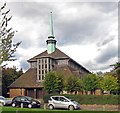
Holy Cross, Ferrymead Gardens, Greenford
Image: © John Salmon Taken: 13 Nov 2006
0.08 miles
8
Ferrymead Gardens, Greenford
Image: © David Howard Taken: 31 Dec 2015
0.08 miles
9
Oldfield Lane South at the junction of Costons Lane
Image: © David Howard Taken: 31 Dec 2015
0.08 miles
10
Greenford: Church of the Holy Cross (New Church)
This church was designed as a replacement for Image which had become too small for the rapidly growing population of Greenford in the 1930s. Construction of the Grade II* Listed Building commenced in 1939 and was completed, despite interruption during the war, by 1941. Its tithe barn style was designed by Sir Albert Richardson. The Old Church was closed in 1951 and its demolition was considered. However its historic and architectural significance were recognised and it was reprieved, being reconsecrated in 1956. Today it is used for services where the congregation is anticipated to be less than 100, while the New Church is used for larger events.
Image: © Nigel Cox Taken: 18 Aug 2013
0.08 miles
  • ...