IMAGES TAKEN NEAR TO
Sarsfield Road, GREENFORD, UB6 7AB
Introduction
This page details the photographs taken nearby to Sarsfield Road, UB6 7AB by members of the Geograph project.
The Geograph project started in 2005 with the aim of publishing, organising and preserving representative images for every square kilometre of Great Britain, Ireland and the Isle of Man.

There are currently over 7.5m images from over14,400 individuals and you can help contribute to the project by visiting https://www.geograph.org.uk
Image Map
Images are licensed for reuse under creativecommons.org/licenses/by-sa/2.0
Notes
- Clicking on the map will re-center to the selected point.
- The higher the marker number, the further away the image location is from the centre of the postcode.
Image Listing (20 Images Found)
Images are licensed for reuse under creativecommons.org/licenses/by-sa/2.0
Image
Details
Distance
6
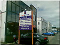
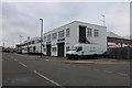
Perivale Business Centre, Wadsworth Road
Image: © Alex McGregor
Taken: 20 Jun 2011
0.14 miles
7
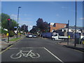
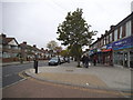
Bilton Road at the junction of Aintree Road
Image: © David Howard
Taken: 3 Aug 2012
0.16 miles
8
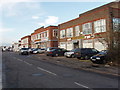
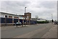
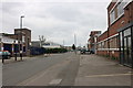
Industrial units, Wadsworth Road
This is an area of light industry. Buildings in the photo include a car accident repair works.
Image: © David Hawgood
Taken: 19 Jan 2007
0.17 miles
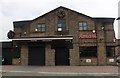
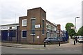
9
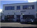
Hillview surgery on Bilton Road, Perivale
Image: © David Howard
Taken: 3 Aug 2012
0.18 miles