1
London Borough of Hillingdon : Church Road A312
Looking along Church Road.
Image: © Lewis Clarke
Taken: 18 Jul 2019
0.15 miles
2
London Borough of Hillingdon : Church Road Houses
Houses on Church Road.
Image: © Lewis Clarke
Taken: 18 Jul 2019
0.15 miles
3
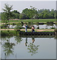
School party at Northala Fields
This park is a great success, with many users, including school parties. here they are by the fishing lakes.
Image: © David Hawgood
Taken: 28 May 2012
0.16 miles
4
Across the lakes in Northala Fields
Northala Fields was opened in 2008 and consists of four artificial hills standing next to the A40 Western Avenue, as well as several fishing lakes and a large field. The hills were constructed using rubble from the demolition of the original Wembley Stadium, which was closed in 2000 and demolished in 2003. The park has won a number of major awards.
The name "Northala" is how the old manor of Northall (Northolt) was recorded in the Domesday Book in 1086.
See also http://www.londongardenstrust.org/features/northala.htm
This view looks across one of the paths between the fishing lakes.
Image: © Marathon
Taken: 20 Apr 2016
0.16 miles
5
Northolt : Church Road A312
Looking along the A312.
Image: © Lewis Clarke
Taken: 12 Sep 2020
0.16 miles
6
Pools at Northala Fields
This new park in the Borough of Ealing will have ponds for model boating, fishing, and wildlife. They are being developed now. Photo from top of one of the conical mounds which are the most obvious feature of the park.
Image: © David Hawgood
Taken: 23 Jan 2008
0.17 miles
7
Northala Fields fishing pools
View from café.
Image: © David Hawgood
Taken: 23 Apr 2011
0.17 miles
8
The lakes at Northala Fields
Northala Fields was opened in 2008 and consists of four artificial hills standing next to the A40 Western Avenue, as well as several fishing lakes and a large field. The hills were constructed using rubble from the demolition of the original Wembley Stadium, which was closed in 2000 and demolished in 2003. The park has won a number of major awards.
The name "Northala" is how the old manor of Northall (Northolt) was recorded in the Domesday Book in 1086.
See also http://www.londongardenstrust.org/features/northala.htm
This view looks from the top of the tallest of the four mounds down to the fishing lakes. The view in the other direction can be seen at http://www.geograph.org.uk/photo/4916705
Image: © Marathon
Taken: 20 Apr 2016
0.18 miles
9
Target Roundabout, Northolt
Western Avenue is in an underpass here. The large McDonald's used to be The Target public house.
Image: © David Hawgood
Taken: 13 Jun 2005
0.18 miles
10
The end of Kentford Way, Northolt
Image: © David Howard
Taken: 30 Apr 2015
0.19 miles


