IMAGES TAKEN NEAR TO
Coldharbour Lane, HAYES, UB3 3HJ
Introduction
This page details the photographs taken nearby to Coldharbour Lane, UB3 3HJ by members of the Geograph project.
The Geograph project started in 2005 with the aim of publishing, organising and preserving representative images for every square kilometre of Great Britain, Ireland and the Isle of Man.

There are currently over 7.5m images from over14,400 individuals and you can help contribute to the project by visiting https://www.geograph.org.uk
Image Map
Images are licensed for reuse under creativecommons.org/licenses/by-sa/2.0
Notes
- Clicking on the map will re-center to the selected point.
- The higher the marker number, the further away the image location is from the centre of the postcode.
Image Listing (29 Images Found)
Images are licensed for reuse under creativecommons.org/licenses/by-sa/2.0
Image
Details
Distance
1
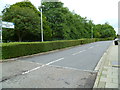
Looking east along St Christopher Drive from Coldharbour Lane
Image: © Shazz
Taken: 12 Sep 2013
0.04 miles
2
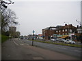
Uxbridge Road, Hayes
The bingo hall pictured in the First Geograph can be seen over the road
Image: © Ray Stanton
Taken: 22 Apr 2007
0.09 miles
3
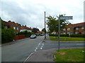
Looking west at the junction of Hesa and Wesley Roads
Image: © Shazz
Taken: 12 Sep 2013
0.09 miles
4
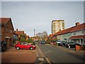
Hayes - Wesley Road
Terrace housing and tower block
Image: © James Emmans
Taken: 20 Nov 2019
0.09 miles
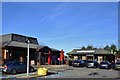
5
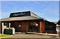
Lombardy Retail Park, Hayes: Pizza Hut
Image: © Michael Garlick
Taken: 10 Nov 2013
0.11 miles
6
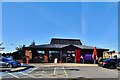
Lombardy Retail Park, Hayes: Pizza Hut
Image: © Michael Garlick
Taken: 10 Nov 2013
0.11 miles
7
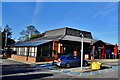
Lombardy Retail Park, Hayes: Pizza Hut
Image: © Michael Garlick
Taken: 10 Nov 2013
0.11 miles
8
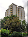
London Borough of Hillingdon : Harding House
A tower block seen from Uxbridge Road.
Image: © Lewis Clarke
Taken: 18 Jul 2019
0.12 miles
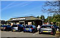
9
Lombardy Retail Park, Hayes: Pizza Hut and McDonald's
Image: © Michael Garlick
Taken: 10 Nov 2013
0.13 miles
10
Lombardy Retail Park, Hayes: McDonald's
Image: © Michael Garlick
Taken: 10 Nov 2013
0.13 miles