IMAGES TAKEN NEAR TO
Recreation Road, SOUTHALL, UB2 5PE
Introduction
This page details the photographs taken nearby to Recreation Road, UB2 5PE by members of the Geograph project.
The Geograph project started in 2005 with the aim of publishing, organising and preserving representative images for every square kilometre of Great Britain, Ireland and the Isle of Man.

There are currently over 7.5m images from over14,400 individuals and you can help contribute to the project by visiting https://www.geograph.org.uk
Image Map
Images are licensed for reuse under creativecommons.org/licenses/by-sa/2.0
Notes
- Clicking on the map will re-center to the selected point.
- The higher the marker number, the further away the image location is from the centre of the postcode.
Image Listing (112 Images Found)
Images are licensed for reuse under creativecommons.org/licenses/by-sa/2.0
Image
Details
Distance
1
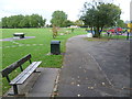
Southall Recreation Ground
Southall Recreation Ground was formerly known as "Bill's Charity Land" and was acquired in two halves by the Council in 1901 and 1911. During drainage excavations the remains of a barge were found about 50 metres from the Lodge, showing that a branch of the canal serviced the local brickfields.
Image: © Marathon
Taken: 1 Oct 2014
0.14 miles

3
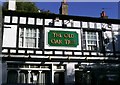
The Old Oak Tree PH, Southall
In The Common, next to the Old Oak Bridge on the banks of the Grand Union Canal.
Image: © Phillip Perry
Taken: 24 Oct 2010
0.15 miles
4
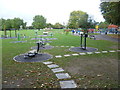
Southall Recreation Ground
Southall Recreation Ground was formerly known as "Bill's Charity Land" and was acquired in two halves by the Council in 1901 and 1911. During drainage excavations the remains of a barge were found about 50 metres from the Lodge, showing that a branch of the canal serviced the local brickfields.
In the distance, the gasholder next to the main line west of Southall station can just be made out.
Image: © Marathon
Taken: 1 Oct 2014
0.15 miles
5
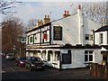
The Old Oak Tree pub, North Hyde
This pub by the canal was almost empty on a weekday between Christmas and New Year.
Image: © David Hawgood
Taken: 29 Dec 2008
0.15 miles
7
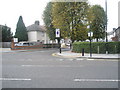
Looking across Montague Waye towards Montague Road
Image: © Basher Eyre
Taken: 3 Oct 2009
0.16 miles
8
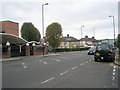
Looking along Montague Waye towards Montague Road
Image: © Basher Eyre
Taken: 3 Oct 2009
0.16 miles
9
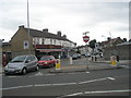
Looking from Montague Waye across to Regina Road
Image: © Basher Eyre
Taken: 3 Oct 2009
0.16 miles