IMAGES TAKEN NEAR TO
Florence Road, SOUTHALL, UB2 5HX
Introduction
This page details the photographs taken nearby to Florence Road, UB2 5HX by members of the Geograph project.
The Geograph project started in 2005 with the aim of publishing, organising and preserving representative images for every square kilometre of Great Britain, Ireland and the Isle of Man.

There are currently over 7.5m images from over14,400 individuals and you can help contribute to the project by visiting https://www.geograph.org.uk
Image Map
Images are licensed for reuse under creativecommons.org/licenses/by-sa/2.0
Notes
- Clicking on the map will re-center to the selected point.
- The higher the marker number, the further away the image location is from the centre of the postcode.
Image Listing (82 Images Found)
Images are licensed for reuse under creativecommons.org/licenses/by-sa/2.0
Image
Details
Distance
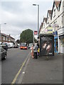
1
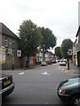
Looking across Western Road into Florence Road
At the bottom of Florence Road is a park where the school team team I managed (Featherstone Middle U-12s) used to play their home matches.
Image: © Basher Eyre
Taken: 3 Oct 2009
0.07 miles
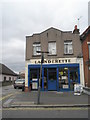
4
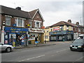
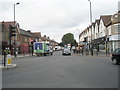
Looking across Western Road towards Florence Road
Image: © Basher Eyre
Taken: 3 Oct 2009
0.11 miles
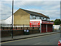
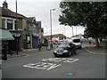
7
Montague Waye at the junction of Western Road
Image: © David Howard
Taken: 13 Oct 2013
0.12 miles
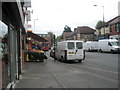
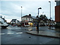
10
Supermarket delivery van in Western Road
Image: © Basher Eyre
Taken: 3 Oct 2009
0.12 miles