IMAGES TAKEN NEAR TO
Scotts Road, SOUTHALL, UB2 5DF
Introduction
This page details the photographs taken nearby to Scotts Road, UB2 5DF by members of the Geograph project.
The Geograph project started in 2005 with the aim of publishing, organising and preserving representative images for every square kilometre of Great Britain, Ireland and the Isle of Man.

There are currently over 7.5m images from over14,400 individuals and you can help contribute to the project by visiting https://www.geograph.org.uk
Image Map
Images are licensed for reuse under creativecommons.org/licenses/by-sa/2.0
Notes
- Clicking on the map will re-center to the selected point.
- The higher the marker number, the further away the image location is from the centre of the postcode.
Image Listing (67 Images Found)
Images are licensed for reuse under creativecommons.org/licenses/by-sa/2.0
Image
Details
Distance
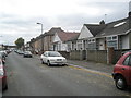
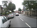
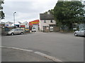
2
Looking from Balfour Road into Johnson Street
Image: © Basher Eyre
Taken: 3 Oct 2009
0.05 miles
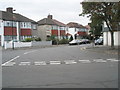
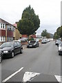
3
Approaching the junction of Balfour Road and Johnson Street
Image: © Basher Eyre
Taken: 3 Oct 2009
0.07 miles
5
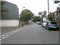
Looking from the Johnson Street junction along Balfour Road
Image: © Basher Eyre
Taken: 3 Oct 2009
0.07 miles
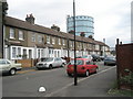
6
Namdhari Community Centre in Balfour Road
Image: © Basher Eyre
Taken: 3 Oct 2009
0.07 miles
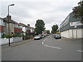
7
Point where Balfour Road and Spencer Street merge
Image: © Basher Eyre
Taken: 3 Oct 2009
0.07 miles
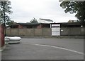
8
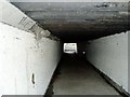
Underpass
This underpass leads from The Straight (Southall Gas works) to Dudley Road.
Image: © J Taylor
Taken: 29 Oct 2008
0.10 miles