IMAGES TAKEN NEAR TO
Guru Nanak Road, SOUTHALL, UB2 4NT
Introduction
This page details the photographs taken nearby to Guru Nanak Road, UB2 4NT by members of the Geograph project.
The Geograph project started in 2005 with the aim of publishing, organising and preserving representative images for every square kilometre of Great Britain, Ireland and the Isle of Man.

There are currently over 7.5m images from over14,400 individuals and you can help contribute to the project by visiting https://www.geograph.org.uk
Image Map
Images are licensed for reuse under creativecommons.org/licenses/by-sa/2.0
Notes
- Clicking on the map will re-center to the selected point.
- The higher the marker number, the further away the image location is from the centre of the postcode.
Image Listing (170 Images Found)
Images are licensed for reuse under creativecommons.org/licenses/by-sa/2.0
Image
Details
Distance
3
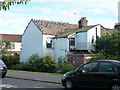
Popular with pigeons
The roof of 53 Victoria Road has a special attraction. Perhaps there is poor roof insulation, but it was a not very cold day in September. Perhaps just a habit carried over from when it really is cold.
Image: © Robin Webster
Taken: 16 Sep 2012
0.06 miles
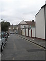
4
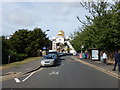
Southall - Havelock Road
View of the Sri Guru Singh Sabha.
Website : http://www.sgsss.org/
wikipedia : https://en.wikipedia.org/wiki/Gurdwara_Sri_Guru_Singh_Sabha
Image: © James Emmans
Taken: 3 Sep 2016
0.07 miles
5
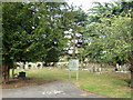
Havelock Cemetery, Southall
On Havelock Road.
Image: © Robin Webster
Taken: 16 Sep 2012
0.08 miles
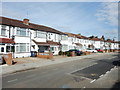
6
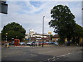
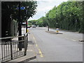
Southall
Junction of Merrick Road (A3005) and Havelock Road
Image: © Ray Stanton
Taken: 29 Jul 2006
0.08 miles
7
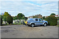
Parks patrol in Havelock Cemetery
The vehicle carries a dog. Whether this was a genuine patrol or just an opportunity to exercise the dog I am not too sure.
Image: © Robin Webster
Taken: 16 Sep 2012
0.08 miles
8
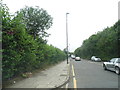
Merrick Road, Southall
This used to be a minor road but was upgraded to divert the main traffic from The Green and other parts of the A3005.
Image: © David Howard
Taken: 17 Aug 2013
0.09 miles
10
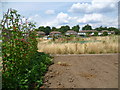
Allotments at Bixley Field
Bixley Field was formerly part of extensive brickfields. In 1826 John Nash used earth from here to supply bricks for his remodelling of Buckingham Palace. The western and northern parts of Bixley Field are entirely taken up by allotments. The northern allotments are rather neglected as seen here compared to the western allotments seen at http://www.geograph.org.uk/photo/4109102
The houses in the distance are in Havelock Road.
Image: © Marathon
Taken: 7 Aug 2014
0.12 miles