IMAGES TAKEN NEAR TO
Argyll Avenue, SOUTHALL, UB1 3AT
Introduction
This page details the photographs taken nearby to Argyll Avenue, UB1 3AT by members of the Geograph project.
The Geograph project started in 2005 with the aim of publishing, organising and preserving representative images for every square kilometre of Great Britain, Ireland and the Isle of Man.

There are currently over 7.5m images from over14,400 individuals and you can help contribute to the project by visiting https://www.geograph.org.uk
Image Map
Images are licensed for reuse under creativecommons.org/licenses/by-sa/2.0
Notes
- Clicking on the map will re-center to the selected point.
- The higher the marker number, the further away the image location is from the centre of the postcode.
Image Listing (104 Images Found)
Images are licensed for reuse under creativecommons.org/licenses/by-sa/2.0
Image
Details
Distance
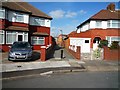
2
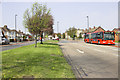
Uxbridge Road, Southall
View from near to junction with Dormers Wells Lane.
Image: © MrC
Taken: 19 Apr 2010
0.02 miles
5
Alley leading from Argyll Avenue to Uxbridge Road
Image: © J Taylor
Taken: 24 Mar 2009
0.03 miles
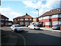
6
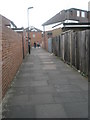
Cut through from the Uxbridge Road to Argyll Avenue
Image: © Basher Eyre
Taken: 3 Oct 2009
0.03 miles
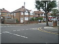
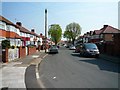
9

Junction of Knowsley Avenue and Green Drive
Image: © Basher Eyre
Taken: 3 Oct 2009
0.04 miles
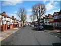
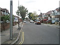
10
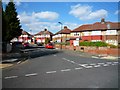
Argyll Avenue at junction with Knowsley Avenue
Image: © J Taylor
Taken: 24 Mar 2009
0.05 miles