IMAGES TAKEN NEAR TO
Agape Way, UB1 1FW
Introduction
This page details the photographs taken nearby to Agape Way, UB1 1FW by members of the Geograph project.
The Geograph project started in 2005 with the aim of publishing, organising and preserving representative images for every square kilometre of Great Britain, Ireland and the Isle of Man.

There are currently over 7.5m images from over14,400 individuals and you can help contribute to the project by visiting https://www.geograph.org.uk
Image Map
Images are licensed for reuse under creativecommons.org/licenses/by-sa/2.0
Notes
- Clicking on the map will re-center to the selected point.
- The higher the marker number, the further away the image location is from the centre of the postcode.
Image Listing (136 Images Found)
Images are licensed for reuse under creativecommons.org/licenses/by-sa/2.0
Image
Details
Distance


7

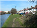
Hillingdon Trail, Grand Union Canal - Paddington Branch
Image: © N Chadwick
Taken: 29 Mar 2014
0.09 miles
8
Bankside, Southall and Grand Union Canal
The bridge in the background carries the Uxbridge Road across the canal.
Image: © Danny P Robinson
Taken: 11 Mar 2007
0.09 miles
9

Firewood collected in Canadian canoe - in Southall
The firewood from woods beside the canal is being taken to a narrowboat with a wood-burning stove. The canoe is on the Paddington Arm of the Grand Union Canal.
Image: © David Hawgood
Taken: 12 Nov 2015
0.09 miles
10
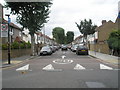
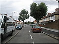
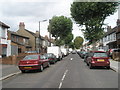
Looking from Beaconsfield Road northwards up Ranelagh Road
Image: © Basher Eyre
Taken: 3 Oct 2009
0.10 miles