
IMAGES TAKEN NEAR TO
Riverside, RICHMOND, TW9 2QJ
Introduction
This page details the photographs taken nearby to Riverside, TW9 2QJ by members of the Geograph project.
The Geograph project started in 2005 with the aim of publishing, organising and preserving representative images for every square kilometre of Great Britain, Ireland and the Isle of Man.

There are currently over 7.5m images from over14,400 individuals and you can help contribute to the project by visiting https://www.geograph.org.uk
Image Map
Images are licensed for reuse under creativecommons.org/licenses/by-sa/2.0
Notes
- Clicking on the map will re-center to the selected point.
- The higher the marker number, the further away the image location is from the centre of the postcode.
Image Listing (240 Images Found)
Images are licensed for reuse under creativecommons.org/licenses/by-sa/2.0
Image
Details
Distance
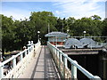
2
![Richmond Lock & Weir [3]](https://s0.geograph.org.uk/geophotos/05/27/47/5274772_808a6c6d_120x120.jpg)
Richmond Lock & Weir [3]
An information board giving details of the structure.
Image: © Michael Dibb
Taken: 26 Jan 2017
0.00 miles
3
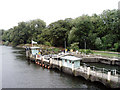
Richmond Lock
The lock is the first to be found when going upstream. The footbridge (from which the picture was taken) and the lock itself are almost entirely within the gridsquare, if only just.
Image: © David Kemp
Taken: 13 Aug 2008
0.01 miles
4
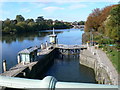
Richmond Lock
The Richmond lock and weir complex was built in 1894 by the Thames Conservancy to maintain a navigable depth of water upstream of Richmond. This then ensures that there is always at least a 1.72m depth of water in the River between Richmond and Teddington.
Image: © Eirian Evans
Taken: 21 Oct 2010
0.01 miles
5
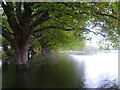
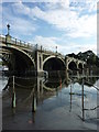
Flooding at Old Deer Park Recreation Ground
This is looking from the footbridge which normally leads across Old Deer Park Recreation Ground. This part of the park alongside the river constitutes a flood storage area, which does from time-to-time provide flood relief for areas around Richmond Lock along this stretch of the Thames.
Image: © Marathon
Taken: 19 Oct 2012
0.01 miles
7
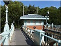
Old toll booth, Richmond lock footbridge
Until 1938 this was a toll bridge, 1d per head. Remains of a turnstile may be seen.
Image: © Robin Webster
Taken: 9 Sep 2012
0.01 miles
8
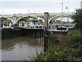
Richmond Lock
River Thames at Richmond Lock
Image: © Shaun Ferguson
Taken: 19 Oct 2012
0.01 miles
9
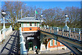
The two footbridges at Richmond Lock
Two walkways run side by side on the upstream and downstream sides of the tidal barrier. Constructed between 1891 and 1894, the barrier is designed to maintain a navigable depth at low tide in the river on the reach upstream to Teddington which would otherwise be fully tidal.
More information on https://en.wikipedia.org/wiki/Richmond_Lock_and_Footbridge
Image: © Des Blenkinsopp
Taken: 15 Feb 2018
0.01 miles
10
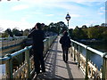
Richmond Lock Footbridge
This lock is the furthest downstream of all the Thames locks and is the only one owned and operated by the Port of London Authority. It was opened in 1894 and is situated close to the centre of Richmond. It connects Richmond on the east bank with the neighbouring district of St. Margarets on the west bank during the day, but is now closed at night to pedestrians.
Image: © Eirian Evans
Taken: 21 Oct 2010
0.01 miles