IMAGES TAKEN NEAR TO
Twickenham Road, ISLEWORTH, TW7 7EJ

Introduction

This page details the photographs taken nearby to Twickenham Road, TW7 7EJ by members of the Geograph project.

The Geograph project started in 2005 with the aim of publishing, organising and preserving representative images for every square kilometre of Great Britain, Ireland and the Isle of Man.

There are currently over 7.5m images from over14,400 individuals and you can help contribute to the project by visiting https://www.geograph.org.uk

Image Map


Images are licensed for reuse under creativecommons.org/licenses/by-sa/2.0
Notes
  • Clicking on the map will re-center to the selected point.
  • The higher the marker number, the further away the image location is from the centre of the postcode.

Image Listing (7 Images Found)

Images are licensed for reuse under creativecommons.org/licenses/by-sa/2.0
Image
Details
Distance
1
Old Milestone by the A310, Twickenham Road, Isleworth
Isleworth stone by the A310, in parish of Hounslow (Hounslow District), Twickenham Road, Isleworth, by No. 433, in garden area between path and access road, and now next to pedestrian crossing. Inscription reads:- ISLEWORTH PARISH LONDON IX MILES TWICKENHAM I TEDDINGTON III Surveyed Milestone Society National ID: MX_IWTW03a
Image: © Milestone Society Taken: Unknown
0.03 miles
2
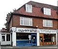
Vets and Fish and chip shop, Isleworth
Image: © nick macneill Taken: 9 Oct 2012
0.03 miles
3
The fun fair all packed up in Redlees Park and ready to leave town
Image: © Rod Allday Taken: 24 Oct 2022
0.17 miles
4
Worple Road, Isleworth
Image: © David Howard Taken: 18 Oct 2014
0.18 miles
5
Isleworth Leisure Centre and Library
Image: © Rod Allday Taken: 24 Oct 2022
0.20 miles
6
Bus stop and shelter, Twickenham Road, Isleworth
Image: © nick macneill Taken: 9 Oct 2012
0.22 miles
7
Duke of Northumberland's River
Skirting a housing estate at Woodlands, Isleworth, with the Mogden Sewage Purification Works beyond.
Image: © M J Richardson Taken: 24 Jun 2012
0.24 miles