IMAGES TAKEN NEAR TO
Vicarage Farm Road, HOUNSLOW, TW5 0DR
Introduction
This page details the photographs taken nearby to Vicarage Farm Road, TW5 0DR by members of the Geograph project.
The Geograph project started in 2005 with the aim of publishing, organising and preserving representative images for every square kilometre of Great Britain, Ireland and the Isle of Man.

There are currently over 7.5m images from over14,400 individuals and you can help contribute to the project by visiting https://www.geograph.org.uk
Image Map
Images are licensed for reuse under creativecommons.org/licenses/by-sa/2.0
Notes
- Clicking on the map will re-center to the selected point.
- The higher the marker number, the further away the image location is from the centre of the postcode.
Image Listing (29 Images Found)
Images are licensed for reuse under creativecommons.org/licenses/by-sa/2.0
Image
Details
Distance
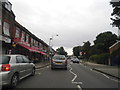
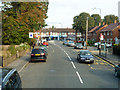
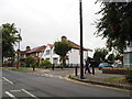
2
Vicarage Farm Road at the junction of Cranford Lane
Image: © David Howard
Taken: 13 Oct 2013
0.03 miles
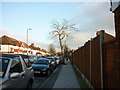
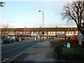
3
Approaching the shops, Heston
From the top of a 111 bus, with the bus stops here called 'Heston Health Centre'.
Image: © Robin Webster
Taken: 22 Sep 2012
0.04 miles
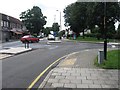
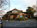
7
Vicarage Farm Road at the junction of Orchard Avenue
Image: © David Howard
Taken: 17 Aug 2013
0.05 miles
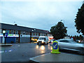
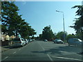
8
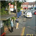
Heston Health Centre bus stop
Towards Hounslow.
Image: © Robin Webster
Taken: 22 Sep 2012
0.08 miles