IMAGES TAKEN NEAR TO
Basildene Road, HOUNSLOW, TW4 7LF
Introduction
This page details the photographs taken nearby to Basildene Road, TW4 7LF by members of the Geograph project.
The Geograph project started in 2005 with the aim of publishing, organising and preserving representative images for every square kilometre of Great Britain, Ireland and the Isle of Man.

There are currently over 7.5m images from over14,400 individuals and you can help contribute to the project by visiting https://www.geograph.org.uk
Image Map
Images are licensed for reuse under creativecommons.org/licenses/by-sa/2.0
Notes
- Clicking on the map will re-center to the selected point.
- The higher the marker number, the further away the image location is from the centre of the postcode.
Image Listing (39 Images Found)
Images are licensed for reuse under creativecommons.org/licenses/by-sa/2.0
Image
Details
Distance
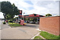
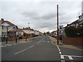
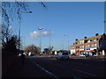
1
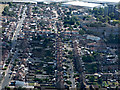
Hounslow West from the air
Looking along Legrace Avenue towards the industrial units at Beavers Lane.
Image: © Thomas Nugent
Taken: 22 Jun 2015
0.04 miles
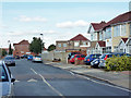
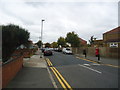
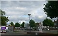
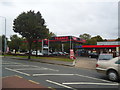
5
Bath Road
The roundabout in the middle distance is where the A30 splits off the A4. A plane can be seen in the last minute of its approach to Heathrow Airport.
Image: © David Squire
Taken: 11 Jan 2006
0.11 miles